

Policy Initiatives
NAAA represents the interests of agricultural aviation pilots, operators and allied industry in affecting positive change through education and political action on the national level. The key issues listed here are itemized generally by the Federal Agencies charged with regulating them.
Environmental Issues
NAAA works to educate policymakers and affect congressional and federal agency and judicial decisions to ensure their policies for pest control, plant health, environmental protection, and vector control pertaining to the use of pesticides and fertilizers use the best available science, professional techniques, and modern application technologies used by the aerial application industry; as well as the benefits aerial application provides agriculture and the environment.
The federal requirements for the registration of pesticide products changed significantly when the Food Quality Protection Act (FQPA) of 1996 was enacted. The law required all pesticides registered under the Federal Insecticide, Fungicide and Rodenticide Act (FIFRA) also meet several new safety criteria. These include consideration by the Environmental Protection Agency (EPA) and mitigation of potentially cumulative exposures from direct and indirect methods, such as drinking water, bystander spray drift or residential home and garden uses. FQPA also required additional protection of special subpopulations that may be more susceptible, such as infants and children. The law requires the review every 15 years of all pesticide product registrations, considering any new science or exposure information. The aerial application industry and its customers have been and continue to be affected by FQPA and the registration review process. Under the law, EPA was originally supposed to complete this second FQPA review of all pesticide products before October 1, 2022, but Congress extended the deadline until October 1, 2026 to lessen the threat of legal action.
One of the most critical issues besetting pesticide programs is the implementation of the Endangered Species Act (ESA) into the registration process. Over the past decade, EPA has been sued on numerous occasions for its failure to consult with the Fish and Wildlife Service and the National Marine Fisheries Service (the Services) about the impact of EPA-registered pesticides on endangered species and species habitat. These lawsuits cover hundreds of endangered species and numerous pesticide active ingredients. EPA and the Services have different approaches to pesticide risk assessment and have not been able to resolve their differences despite a continuous effort over the past decade. The Services also lack the resources to complete ESA consultations for all registered pesticide products.
There are several stages during the registration review process. The risk assessments are the first round of documents written by EPA once a product enters the review process. They rely heavily on models to assess the risks pesticides pose to the environment and human health. The proposed interim decisions (PID) are the next phase of the review process. The agency uses the risk assessments as a basis for deciding whether a product should be re-registered and what restrictions should be placed on how it is used. The final interim decision (ID) follows, after the EPA considers comments received on the PID and makes any changes they deem necessary.
The decisions are considered interim instead of a full re-registration of a product because EPA must still complete an Endangered Species Act (ESA) consultation with the Fish and Wildlife Service (FWS) and National Marine Fisheries Service (NMFS), as well as an endocrine disruptor screen. The ESA requires that EPA work with the Services to evaluate the potential risks each pesticide represents to threatened and endangered species and their designated habitat. The process begins with the EPA conducting a Biological Evaluation (BE) of how the pesticide could impact endangered species. Then the FWS and NMFS issue Biological Opinions (BiOps) that further examine how the pesticide will impact endangered species and their habitats. Once the BEs and BiOps are completed, EPA consults with FWS and NMFS to issue a final decision on re-registration for the pesticide being reviewed. EPA is encouraging registrants to place additional application restrictions on labels up-front to ease the consultation process. NAAA continues to work with registrants, other stakeholders, and EPA to preserve key aerial uses during the registration review process. These include USDA’s Office of Pest Management Policy (OPMP) to assist the office as it weighs in with EPA on product benefits and risk assessments. In addition to working with USDA, EPA, registrants and grower groups, NAAA is represented on the EPA’s Pesticide Policy Dialogue Committee (PPDC). The PPDC is a federal advisory committee that provides a forum for a diverse group of stakeholders to provide feedback to the EPA’s Office of Pesticide Programs on various pesticide regulatory, policy and program implementation issues. Stakeholders include academia, state and local regulatory officials, environmental activists, grower groups and pesticide manufacturers themselves.
- NAAA has commented to EPA on the need to use Tier 3 rather than Tier 1 of the AgDRIFT atmospheric software that models aerial pesticide movement after the application. Tier 3, compared to Tier 1, takes into account much more realistic aerial droplet sizes, aircraft, boom drop systems and other setups and practices standard in today’s aerial application industry.
- Commenting to EPA on the need to make all buffer zones wind-directional.
- NAAA has commented to EPA on the need to increase maximum allowed wind speed for aerial applications from 10 mph to 15 mph.
- NAAA has educated EPA about the aerial application industry’s education and training program results. For example, the PAASS (Professional Aerial Applicator Support System) program and Operation S.A.F.E. (Self-regulating Application & Flight Efficiency) fly-ins, C-PAASS (Certified Professional Aerial Applicator Safety Steward)
- NAAA continuously monitors the Federal Register for all new registrations, registration reviews, and other proposed rules to ensure pesticides can be applied by aerial application.
- Since 2017 NAAA has submitted the following to EPA
- Comments for 240 pesticides
- 299 total comments and other letters
- Major policy victories include:
- Many products are now registered with a 15-mph wind speed limit.
- Requires 65% boom for fixed wing aircraft and 75% boom for helicopters in 11 to 15 mph winds
- Requires ¾ upwind swath displacement in 11 to 15 mph winds on downwind edge.
- Use of American Society of Agricultural and Biological Engineers (ASABE) standard S572.1 to specify the required droplet size on the label instead of language using specific nozzle types and operating parameters which can change with technological advances.
- EPA switching from Tier 1 to Tier 3 model in AgDRIFT
- EPA moving towards wind-directional buffers in almost all cases
- Many products are now registered with a 15-mph wind speed limit.
- Other common aerial restrictions being proposed for labels during registration review process:
- Not spraying during inversions
- Requires 75% boom for fixed wing aircraft and 85% boom for helicopters in winds up to 10 mph
- 1/2 upwind swath displacement in 11 to 15 mph winds on downwind edge
- Maximum application height of 10 feet unless higher is needed for pilot safety
- Chlorpyrifos
- In November 2023 Eighth Circuit Court of Appeals vacated the Ninth Circuit Court of Appeals 2021 rule prohibiting chlorpyrifos use on food or feed crops.
- As a result of the above action EPA reinstated all tolerances for chlorpyrifos
- EPA indicated they will move ahead with the 2020 chlorpyrifos PID, released before the 2021 ban
- Restricts chlorpyrifos to the following uses: alfalfa, apple, asparagus, cherry, citrus, cotton, peach, soybean, strawberry, sugar beet, wheat, and wheat (winter).
- Additional mitigations may also be required, including a potential ban on aerial applications.
- Beginning in June of 2024, registrants began voluntarily canceling certain products or amending registrations to restrict their use to the 11 crops
- December of 2024 – EPA released the proposal to revoke chlorpyrifos tolerances for all crops except alfalfa, apple, asparagus, cherry, citrus, cotton, peach, soybean, strawberry, sugar beet, wheat, and wheat (winter). The revised PID is expected in 2026.
- 2025 – NAAA submitted comments on EPA’s proposal to revoke tolerances to all but the above mentioned 11 crops highlighting the importance of aerial applications of chlorpyrifos and recommending EPA reconsider the revocation, particularly for corn and sunflowers
- Paraquat
- In 2021 PID for paraquat proposed banning all aerial applications of paraquat
- After NAAA comments, final ID allows aerial but limits many applications to 350 per day per pilot for all aerial applications except cotton and soybean desiccation. This was based on inhalation concern for pilots.
- In 2024 NAAA commented to an EPA reconsideration on paraquat ID asking EPA to increase allowable daily acres aerial applications of paraquat for herbicidal uses.
- New Weather measuring requirements in fall of 2023.
- Weather forecast must be checked 12 hours before application.
- Wind speed and direction must be measured on site at the application height
- Must be rechecked every 15 minutes during application.
- Dicamba
- 2025- NAAA commented on the proposed registration of three new formulations of dicamba for use on dicamba tolerant crops. As in the prior attempts to register these products for dicamba tolerant crops, aerial application was prohibited. NAAA commented in favor of allowing aerial application, focusing on the importance of timely applications and drift mitigation options, as detailed in the herbicide strategy, that would allow aerial applications to be made safely. Grower groups, such as the American Farm Bureau Federation were also interested in NAAA’s position and supported NAAA’s position that aerial application should be allowed for over the top dicamba applications.
- EPA resolved longstanding litigation (megasuit) covering over 1,000 pesticide products, allowing EPA to fulfill its obligations to protect endangered species while conducting reviews and approvals of pesticides. It Required EPA to develop mitigation measures as detailed in ESA workplan, vulnerable species pilot project (VSPP), herbicide strategy, and forthcoming rodenticide strategy, insecticide strategy, and fungicide strategy which will identify ESA mitigation measures for entire classes of pesticides.
- NAAA ensured aircraft smokers and other types of meteorological measuring technology can be used to verify wind; now on labels
- ESA Workplan – lays out plan for EPA to improve EPA’s efficiency with meeting its ESA obligations and reduce the need to consult with the U.S. Fish and Wildlife Service and the National Marine Fisheries Service.
- Result of settlement agreement in the “Mega Lawsuit”, filed by numerous environmental activists groups alleging EPA has failed to abide by ESA.
- ESA Workplan update
- Details how pesticide labels will use Endangered Species Bulletins Live! Two (BLT) website to show applicators’ location of ESA pesticide use limitation areas (PULA) are located and provide access to any additional mitigations needed when applying near the species.
- Proposes use of wind-directional buffers
- Vulnerable Species Pilot Project (VSPP): focused on a group of 27 species that are particularly vulnerable to harm from pesticides; NAAA submitted comments.
- Some PULAs would be specific, others vague.
- Proposed wind-directional buffers
- Acknowledged need to move from Tier 1 to Tier 3 in AgDRIFT
- Update based on public comments narrowed species range maps, clarified non-ag uses, and revised mitigations.
- Herbicide strategy
- Draft released in July 2023; NAAA submitted comments
- Protect ESA species and habitat from herbicides in lower 48 states
- Drift mitigations proposed for aerial applications focused on wind directional buffer zones
- Uses BLT to show PULAs and access bulletins with mitigations
- PULAs unnecessarily large – based on range instead of locations; would increase cropland affected by ESA mitigations
- Update released in 2024 suggesting refined PULAs and move to Tier 3
- Final strategy released in August of 2024
- All buffer zones downwind
- Distance based on risk of species and pesticide in question; will range from 50 to 320 feet.
- Buffer distances can be reduced by increasing droplet size, using a drift reduction adjuvant, when applying to a small field only requiring a few passes, when there is a windbreak or similar vegetative barrier present, and when humidity is higher than 60%.
- Managed areas such as other fields, roads, managed wetlands, field borders, etc. can all be included as part of the buffer
- Mitigations and managed areas will be expanded upon as new data becomes available.
- Hawaii strategy – because of its unique nature, Hawaii is receiving an ESA strategy specific to it. NAAA assisted USDA OPMP in determining the extent of aerial applications in Hawaii
- Once finalized, strategies will be implemented as part of registration review or new registration process for every pesticide.
- Insecticide Strategy
- July of 2024 – draft insecticide strategy released – it was very similar to the final herbicide strategy. Wind directional buffer zones, distance can be reduced by using mitigations including larger droplets, and managed areas will count as part of buffer. NAAA requested boom length reductions be added as a drift mitigation option. The ecological mitigation support document that was released with the insecticide strategy finally accepted NAAA’s recommendations to switch from the Tier 1 to the Tier 3 AgDRIFT model and improve the assumptions. EPA changed the default aircraft to an AT-802 with a corresponding increase in swath width and decrease in the number of passes. The default droplet size was increased to medium, atmospheric stability was set to a level that rules out the presence of an inversion. EPA also changed the height at which wind speed is measured to reflect smokers and onboard meteorological measurement systems and increased the upwind swath displacement to reflect what is actually practiced in the industry. There were two assumptions EPA did not agree with completely on with NAAA – surface roughness and standard boom drop. While EPA did not agree with the values proposed by NAAA, they did not disagree with the logic behind our recommendations.
- April 2025 – final insecticide strategy released. Wind directional buffer zones are the mitigation option to reduce risk of drift. They can be on label to protect unmanaged areas and on BLT to protect PULAs. Maximum buffer distance is 300 feet for aerial applications; reduced by mananged areas as part of buffer and drift mitigation measures. Each mitigation measure is assigned a percentage reduction for buffer distance; perccentages are cumalitive. It is possible to eliminate the need for a buffer by either managed areas or mitigation measures. See www.epa.gov/pesticides/mitigation-menu for current ist of managed areas and mitigation measures. The use of a website instead of label will allow new application technologies to be added for buffer reduction measures. Growers will need to comply with a mitigation system to reduce off site exposure from runoff/erosion. Commerical applicators will need to require customer records for their application records to confirm compliance. EPA is working on refining the size and scope of PULA’s to better reflect locations where endangered species actually occur.
- 2025 – NAAA worked with Syngenta to support aerial applications for their new insecticide isocycloseram. This registration used the recently finished insecticide strategy. EPA’s initial registration proposal was only going to allow aerial applications of the insecticide on cotton. NAAA provided data to support aerial applications for all crops. The proposed registration approval was released in May of 2025; EPA proposed to approve aerial applications of isocycloseram for only corn, soybean, potatoes, and cotton. For corn and soybean, aerial applications would only be allowed in a limited number of states. For corn, aerial application of isocycloseram would only be allowed in CO, KS, NE, OK, and TX; for soybean, aerial applications would only be allowed in AL, AR, GA, LA, MS, MO, NC, OK, SC, TN, and TX. NAAA commented on the need for aerial application of isocycloseram on corn and soybeans in all states and how the insecticide strategy would allow these applications to occur and protect endangerd species.
- EPA’s BiOp for carbaryl proposed a 150-foot non-wind directional buffer zone for aquatic areas for aerial applications; it’s 25 feet for ground applications. It was unclear if the buffers were intended to protect against runoff, drift, or both. NAAA commented that all drift reduction buffer zones should be wind directional, and that if the buffer is intended to protect from runoff there should be no difference between buffer distance for ground and aerial. The issue of non-wind directional buffers for aqutic areas is expected to continue to be an issue.
- Isocycloseram was registered in November 2025. All of the proposed aerial prohibitions and restrictions from the proposed registration were kept in the final registration. NAAA will continue to work to increase the types of crops and the states for aerial applications of isocycloseram.
- NAAA commented in favor of the registration for a new herbicide, epyrifenacil; all proposed drift mitigations are acceptable expect one. NAAA objected to the statement “When applying to crops via aerial application equipment, the spray boom must be mounted on the aircraft to minimize drift caused by wing tip or rotor blade vortices” as being vague. NAAA also objected to a minimum spray application rate of 7 gallons per acre (GPA). NAAA commented on the atrazine BiOp, supporting the proposed aerial drift mitigations.
FIFRA for decades regulated at the federal level all aspects of pesticide use, and it was, until 2009, uncommon for Clean Water Act (CWA) rules to come into play for the aerial application industry—for example, avoiding applications outside of buffer zones set up around specific aquatic habitat and wetlands, or to impaired river segments or lakes covered by Total Maximum Daily Loads (TMDLs) designed to help meet state water quality standards. However, a 2009 decision of the Sixth Circuit U.S. Court of Appeals (National Cotton Council, et al., v. EPA) brought the full weight of the CWA into the realm of FIFRA and aerial application businesses. With this ruling, pesticide applications made into, over or near “waters of the U.S.” according to FIFRA product labels must also comply with the additional requirements of an NPDES pesticide general permit (PGP).
As much as aerial and ground contract pesticide applicators were affected by this ruling, government agencies with pest control responsibilities are even more affected. These include primarily federal, state, and municipal water programs and pest control agencies, for they are the “decision makers” who must comply with the broadest range of PGP requirements. Also, in this group can be public health agencies and mosquito control organizations; wildlife agencies and large aquatic weed control companies; irrigation districts; managers of highways, roads and utility rights-of-ways; and forest and park managers. Obviously, there is a lot of shared burden, especially for a permit that most states agree contributes little environmental benefits over existing FIFRA and state pesticide programs.
The types of pesticide applications that are regulated by the permit include: mosquito and other flying insect pest control; weed, algae and pathogen pests in waters at water’s edge, including ditches and/or canals; animal pest control in water and at water’s edge; and forest canopy pest control where a jurisdictional waterbody is under the canopy and may be affected by the applied pesticides. Some state PGPs add other covered uses, such as for control of weeds on right-of-way or in rangeland. An explanation of the types of parties that are likely to fall into these use categories is available on EPA’s pesticide permitting webpage.
To meet the court’s requirement, EPA and 45 separate states first developed PGPs in 2011 and have been implementing them since. These five-year permits vary widely in requirements. On October 31, 2021, EPA reissued its PGP for another five-year cycle and an updated PGP proposal has recently been proposed. Permit fees vary from a few hundred dollars to over $1,000 in some states, and PGPs have increased compliance costs and manpower resource needs for all involved. Worse than these costs, however, is the legal risk – failure to comply with the permits can result in hefty agency fines and penalties, as well as potential citizen suits over alleged violations. For the states in which NAAA members operate, it is imperative aerial applicators know what is needed to avoid violating these PGPs and triggering enforcement action, or worse, citizen suits.
State PGPs differ significantly: EPA’s PGPs regulate pesticide applications in Massachusetts, New Hampshire, New Mexico, and Idaho and the District of Columbia; all U.S. territories except the U.S. Virgin Islands; federal facilities in Delaware, Vermont, Colorado, and Washington; discharges in Texas that are not under the authority of the Texas Commission on Environmental Quality, including activities associated with oil and gas exploration; and all areas of Indian Country that are not covered by an EPA-approved permitting program. The other 44 states not covered by EPA’s PGP have some form of state PGP in place, but they do vary considerably. That means if you have pesticide applications that extend across state borders you may need to comply with a number of different PGP requirements.
State PGPs fall into three categories: 1) PGPs which have extensive compliance requirements for all dischargers (e.g., NY, CA, KY, WA, WI); 2) PGPs which extend automatic coverage and legal protections to all operators as long as they meet permit conditions (e.g., LA, SD, MD, VA, ND, CO); and 3) PGPs that only have extensive requirements for government agencies and other large entities whose pesticide applications exceed annual treatment thresholds, but modest requirement for others below annual thresholds (e.g., FL, IA, OH, SC, PA, OR). In an effort to compare state permits, NAAA has analyzed each state’s permit and contrasted them in a chart.
It is important aerial applicators know which PGP requirements apply to their businesses. To help educate members, NAAA has developed a comprehensive document that outlines aerial applicator’s obligations under the NPDES pesticide general permit. In the PGP, applicators have less burdensome requirements than government agencies, landowners, and other major pest-control decision-makers who have control over pesticide applications into, over or near US waters. However, if an aerial applicator makes the pesticide application decisions for his clients, that applicator may become a “decision-maker” and then must comply with all applicable requirements imposed on both applicators and decision-makers. It is important that aerial applicators know what distinguishes the requirements of “for-hire” applicators from those of “decision-makers.” Thus, operators and their clients should have an agreement in place clearly delineating the role of the client decision-maker and applicator for each application made. To assist NAAA members, NAAA has developed sample contract language for reference when preparing contract negotiation with clients delineating that the aerial applicator is not the decision-maker.
In November 2023, EPA released the draft 2026 PGP. On October 4, 2021, the Center for Biological Diversity (CBD) filed a petition for review with the Ninth Circuit regarding the 2021 Pesticide General Permit (PGP). EPA, U.S. Fish and Wildlife Services, and CBD entered into a settlement agreement on July 25, 2023 to resolve the litigation. On December 19, 2024, CBD filed a consent motion to voluntarily dismiss the appeal. As part of the Settlement Agreement, EPA agreed to issue the final 2026 PGP on or prior to December 17, 2024. The permit would still take effect October 31, 2026, when the current 2021 PGP expires.
NAAA’s commented on the 2026 draft and its comments were like its earlier comments and touched on the redundancy of the PGP, considering that all pesticides, including those for aquatic sites, already undergo a registration and then a reregistration review process to verify their safety to the environment when used according to label directions. NAAA did point out that Endangered Species Act (ESA) requirements on the PGP are yet another redundancy considering EPA’s recent spate of efforts to address ESA issues in pesticide registration and review processes. NAAA also expressed concerns about updated site monitoring and record keeping requirements, some of which fall on the applicator. NAAA pointed out these requirements have the potential to be overly burdensome to aerial application operations, many of which are small businesses. Other industry comments also urge the EPA to eliminate joint and several liability provisions from the PGP, as they set a concerning precedent for their activities. Also, requests were made for clarification that the PGP does not apply to stormwater discharges that do not currently require an NPDES permit.
Notable changes in the draft 2026 National Pollutant Discharge Elimination System (NPDES) Pesticide General Permit (PGP) compared to the 2021 PGP. Key proposed modifications include Enhanced Visual Monitoring and Documentation:
- Introduction of Part 4.3, “Documentation of Visual Monitoring,” emphasizing the requirement to record visual monitoring activities as outlined in Parts 7.2, 7.3, and 7.4.
- Addition of Part 4.4, “Additional Monitoring,” highlighting that EPA may mandate further monitoring to ensure compliance with the PGP.
- Requirement for Decision-makers to submit a Pesticide Discharge Management Plan (PDMP) alongside their Notice of Intent (NOI) as specified in Part 5.
- Inclusion of visual monitoring procedures within the PDMP content requirements.
- Mandate that records of visual monitoring include specific details such as date, time, and location.
- Obligation for Decision-makers to submit visual monitoring records with their Annual Report.
All PGPs include these minimum requirements:
- Carefully handle and store pesticide products to avoid leaks and spills
- Promptly deal with spills following manufacturer recommendations
- Comply with the FIFRA labels on products they are hired to apply
- Properly mix and load pesticides into their aircraft
- Properly rinse and recycle/dispose of empty pesticide containers
- Properly clean their spraying system after application
- Preventatively maintain those pesticide-application systems to avoid leaks
- Calibrate aircraft spraying systems so they apply the proper amount of pesticides
- Properly identify and direct the application to desired boundaries using GPS when feasible or on-ground flagging
- Properly apply the pesticide products to the appropriate location and at the proper rate
- Keep proper records of all regulated activities
- Communicate this information to clients in a timely manner for the permit compliance needs of those organizations
- Monitor equipment during application to ensure proper functioning and to avoid off-target application. Records of these activities are necessary, as are spray logs.
NAAA has prepared a checklist of compliance activities for aerial applicators’ aid in complying with this burdensome task. Should an applicator determine that the manner in which any of these activities is performed is not satisfactory, or should an adverse incident occur for an applicator, the practices would need to be upgraded before the next pesticide application, and any adverse impact reported to the EPA or the state permitting agency.
Efforts to encourage Congress to address legislative fixes to NCC vs. EPA by NAAA and its ag/pesticide user stakeholder coalition have been underway since the court’s decision in 2009. The House has passed legislation, titled the Reducing Regulatory Burdens Act, that would create a legislative exemption for NPDES permitting of pesticides several times as either free standing legislation or part of various iterations of House Farm Bills. NAAA is working to get NPDES permit relief included in the 2025 Farm Bill.
The CWA does not define WOTUS; since the 1970’s, the EPA and Army have defined it by regulation. Four Supreme Court decisions addressed the definition over the years. The 2015 Clean Water Rule wholly redefined WOTUS but was repealed by a 2019 Rule which reinstated the prior regulations, implemented consistent with the Supreme Court decisions and applicable guidance. However, the 2019 Rule was replaced with the Navigable Waters Protection Rule (NWPR) in 2020, which itself had implementation halted in 2021 due to other litigation.
The “Revised Definition of ‘Waters of the United States’” rule took effect on March 20, 2023 being codified in place of the NWPR. However, effective September 8, 2023, the EPA amended this rule to conform to a Supreme Court decision invalidating the “significant nexus standard” test to identify waters that, either alone or in combination with similarly situated waters in the region significantly affect traditional navigable/interstate waters.
EPA released a proposal to update the definition of Waters of the United States (WOTUS) in November of 2025 that attempts to reduce regulatory burdens and associated costs with compliance. To achieve these aims, EPA proposes narrowing the scope of jurisdiction to relatively permanent waters and wetlands that maintain a continuous surface connection to such waters. The rule also refines key terms, including “relatively permanent” and “tributary,” and clarifies long-debated exclusions for features such as certain ditches, prior converted cropland, waste treatment systems, and groundwater. EPA maintains that these updates directly address longstanding stakeholder requests for clearer, more predictable standards that lessen compliance uncertainty and litigation risk. The agency defines “relatively permanent” to mean “standing or continuously flowing bodies of surface water that are standing or continuously flowing year-round or at least during the wet season.” The agency defines “tributary” to mean “a body of water with relatively permanent flow, and a bed and bank, that connects to a downstream traditional navigable water or the territorial seas, either directly or through one or more waters or features that convey relatively permanent flow.” Further, the proposed definition of “tributary” clarifies that a “tributary does not include a body of water that contributes surface water flow to a downstream jurisdictional water through a feature such as a channelized non-jurisdictional surface water feature, subterranean river, culvert, dam, tunnel, or similar artificial feature, or through a debris pile, boulder field, wetland, or similar natural feature, if such feature does not convey relatively permanent flow.
EPA also underscored the rule’s economic implications, noting that improved regulatory clarity stands to benefit farmers, ranchers, and developers who rely on consistent water-related permitting frameworks. The proposal, if made permanent and remains unchanged by subsequent administrations, will reduce the areas required to obtain a pesticide general permit under the Clean Water Act’s National Pollutant Discharge Elimination System (NPDES). NAAA will continue to advocate for changes to the rule that provide additional clarity for our members about which waters are subject to federal regulation, including NPDES permits.
To protect the public’s health, and to protect farmers from unnecessary and burdensome regulations stymying them from producing food, fiber, and biofuel, NAAA urges Congress to exempt applications of EPA-approved pesticides from the NPDES pesticide general permit requirements.
On December 11, 2025, the House of Representatives passed H.R. 3898, the “Promoting Efficient Review for Modern Infrastructure Today (PERMIT) Act” (HR 3898), which among other permit reforms, would clarify that NPDES permits are not needed for applications for EPA registered pesticides. The legislation was championed by Rep. David Rouzer (R-NC), House Transportation and Infrastructure Committee Water Resources and Environment Subcommittee Chairman Mike Collins (R-GA) and other committee leaders. NAAA encourages the Senate to take similar action. NAAA also supports and advocates for the inclusion of NPDES permit relief in the next Farm Bill or any other appropriate legislation.
PFAS have presented liability issues for manufacturers for decades and now, the issue has become of increasing concern to agriculture. PFAS is used in non-stick cookware, food packaging, water-repellent apparel, stain-resistant carpet, and hundreds of consumer and industrial goods and applications. PFAS (pronounced PEA-fass) are a broad class of synthetic chemical compounds, currently estimated to number around 10,000. So called “forever chemicals” because of their bio-accumulative properties and persistence in the environment over time, PFAS have widely been used in the U.S. and around the world since at least the 1940s. They are found in water, soil, air, and plants and detected in the blood of humans, animals, and fish. Some are known to be “toxic,” and have been linked to cancer, developmental disruptions, and other adverse health conditions. Since 1999, tens of thousands of lawsuits have been filed against chemical companies over PFAS exposure. Legislation and regulatory activity have increased, with states imposing bans and EPA implementing policies. The definition of pesticides as PFAS could potentially jeopardize their availability and create additional liability. For the aerial application industry, the concern around PFAS rules relates to the presence of PFAS in fluorinated high-density polyethylene (HDPE) containers and the use of PFAS for inert ingredients in manufacturing certain pesticide formulations. There are two fronts to the PFAS issue for aerial and other pesticide applicators – the first is eliminating the use of PFAS in the production of pesticide containers and formulations. The second is ensuing aerial applicators are not exposed to litigation as a consequence of applying pesticides that contained trace PFAS amounts, either from container leaching or in the pesticide formulations.
- In 2021 the EPA released its Strategic Roadmap through 2024, outlining key actions the agency would be taking to address issues around accountability and the human health and environmental impacts of PFAS. The EPA’s strategic roadmap on PFAS was released, detailing the number of regulatory steps the agency has taken so far.
- In March of 2021 EPA released data showing PFAS contamination from the fluorinated HDPE containers used to store and transport a mosquito control pesticide product.
- In September of 2021 EPA released a method to pesticide manufacturers for detecting PFAS in pesticide products formulated in oil, petroleum distillates, or mineral oils. EPA used the method to determine no PFAS were present in three formulated mosquito control products.
- In March of 2022 EPA provided information to manufacturers of HDP) containers and similar plastics about the potential for PFAS to form and migrate from these items. EPA issued an open letter to raise awareness to industry of this issue in order to help prevent unintended PFAS formation and contamination and to outline certain requirements under the Toxic Substances Control Act (TSCA) as it relates to PFAS and fluorinated polyolefins.
- In September of 2022 EPA released results from its evaluation on the leaching potential of PFAS from the walls of certain fluorinated HDPE containers into the liquids stored in those containers. Results from this study indicated that PFAS present in the inside walls of the fluorinated HDPE containers can be readily leached into formulated liquid products.
- In May 2023 EPA released laboratory results related to the analysis of ten pesticide products reported to contain PFAS residues. EPA did not find any PFAS in the tested pesticide products, differing from the results of a published study in the Journal of Hazardous Materials. EPA is also released a newly developed analytical methodology used in the testing process alongside the summary of its findings.
- In 2023 the Senate released for public comment a draft bill (S.1427 – Agriculture PFAS Liability Protection Act of 2023) that seeks to protect passive receivers, like farms, from PFAS lawsuits. Of particular significance, though, is the provision to establish a federal definition of PFAS, providing clarity, consistency, and more predictability for industry and stakeholders. Although pesticides are not explicitly mentioned in the bill, crop protection advocates point out that FIFRA regulations already subject pesticides to rigorous scientific testing and therefore, should be excluded from added product regulatory consideration. Cynthia Lummis (R-WY) also introduced a PFAS exemption bill to protect industries like agriculture from Superfund PFAS liability claims
- In February of 2024 EPA released a robust and validated method manufacturers can use to test for 32 PFAS directly from the walls of containers made from high-density polyethylene (HDPE). This method allows industries that use HDPE containers and container manufacturers to test the containers before use, preventing PFAS contamination of products stored in these containers.
- In July 2024 EPA granted a petition from numerous environmental groups to address PFAS used in a variety of plastic containers, including those used to store pesticides.
- Many states are not waiting for the federal government to develop a clear and concise definition of PFAS and are forging ahead with their own definitions and regulatory schemes. Outright bans on a wide range of products containing PFAS have been imposed in Maine, Minnesota, and Washington, and at least ten other states have passed limited scope bans, phase outs, or caps on the amounts of allowable PFAS. With state legislative sessions ramping up or preparing to begin, we are already seeing concerning prohibition bills in New Hampshire, New Jersey, and Vermont.
- In October of 2024 USDA-ARS stated that that their “data shows that PFAS is an environmental hazard that does not come from agriculture”.
- EPA’s 2025 PFAS efforts focused on drinking water standards.
EPA has focused on refining PFAS reporting rules, proposing exemptions for small quantities and specific activities to ease the Toxic Subtances Control Act (TSCA) reporting burden. They also awarded research grants for agricultural PFAS studies in Texas in November 2025, aiming for more practical data collection.
The issue of drift remains a top concern for the aerial application industry. NAAA monitors EPA’s registrations, registration reviews, and other proposals to ensure drift from aerial applications is accurately modeled and all proposed mitigations are acceptable to the industry. NAAA also monitors activities from numerous other organizations in order to stay up to date on the latest in drift mitigation technologies, standards and policies proposed that could affect aerial applications, and efforts outside of the normal EPA Office of Pesticide Program channels that can affect how drift is assessed or mitigated.
- USDA-ARS AATRU corrected ASABE standard S641 Droplet Size Classification of Aerial Application Nozzles to ensure new standards didn’t change the classification of aerial nozzles from original S572.1; i.e. if a nozzle and its operational parameters had been classified as medium using S572.1, then S641 should also classify it as a medium.
- Administrative control of AGDISP, the parent model of AgDRIFT, was transferred from USDA Forestry Service (FS), under the direction of Dr. Harold Thistle, formerly of the USDA FS, to USDA-ARS Aerial Application Technology Research Unit under the direction of Dr. Brad Fritz following Thistle’s retirement.
- In 2020 the company responsible for writing AgDISP, Continuum Dynamics, moved to a paid subscription-based service for future updates of AGDISP. Since AGDISP was publicly funded, Thistle procured a copy of the latest code for AgDISP but Continuum Dynamics stripped all descriptive information from the code making it difficult to interpret.
- With approval by the NAAA Precision Agriculture Committee, NAAA facilitated the creation of a working group to update the AGDISP model. The project has three main objectives:
- Convert the software into a modern computer programming language that is publicly available.
- Improve the accuracy of the model by factoring in changes in several parameters that change during flight such as aircraft weight and AOA.
- Create a real-time version of the model that could be integrated into ag aircraft GPS to provide real-time and site specific drift modeling in flight.
- AGDISP Modernization Project (AMP)
- EPA has indicated support for updating AGDISP.
- A statement of work and cost estimates were prepared; the project is estimated to cost $600,000.
- NAAA is working with registrants, and ag groups for overall support of the AGDISP update and to solicit for funding.
- The CDC, via application technology consultant Dr. Jane Bonds, has agreed to partially fund the AGDISP project for work they’re doing for mosquito control at $250,000 over five years. NAAREF has contributed $50,000.
- A stakeholder review committee has been established and includes representatives from registrants, the EPA, the USDA, grower groups, and other agricultural associations.
- AMP was awarded $35,000 from The Cotton Foundation
- The update to the models programming language continues.
- EPA’s drift mitigation efforts are focused on ESA strategies. No additional drift mitigation policies or programs are expected
- 2025 The USDA-ARS Aerial Application Technology Unit updated their spray nozzle models and added two new nozzles.
- 2025 – The Unmanned Aerial Pesticide Application System Task Force (UAPASTF) submitted the first-ever Good Laboratory Practices (GLP) data from spray drift field trials using UASS.
- AMP was awarded $35,000 from the National Corn Growers Association. The coding process is expected to begin in March 2026.
- Dairyland Aviation in Wisconsin has begun using an onboard weather measurement system, GPS with the original version of AGDISP, and pulse width modulation nozzle control in combination to predict spray movement in the cockpit and adjust spray passes based on the prediction. Dairyland Aviation will be working with the FWS on a pilot project to explore how this and future advancements can protect endangered species.
On September 28, 2015, EPA finalized extensive revisions to its Worker Protection Standards (WPS) under FIFRA, the first major change to these regulations since 1992. EPA stated its proposal was necessary to reduce the incidence of preventable occupational pesticide exposure and pesticide-related acute and chronic illnesses among agricultural workers (workers) and pesticide handlers (handlers). There were several concerns with the revisions, on which NAAA commented concerns with:
- Requiring a 100-foot aerial entry restriction area around fields at the time of application regardless of wind direction;
- Requirements for exchanged communication by an applicator to the farmer within two hours of any programmatic changes to the application;
NAAA also worked with the U.S. Small Business Administration’s (SBA) Office of Advocacy (Advocacy) on their comments on the WPS. When the rule was finalized, several of the concerns NAAA had expressed in comments had been corrected.
- Annual mandatory training to inform farmworkers on the required protections afforded to them.
- Children under 18 are prohibited from handling pesticides; exemption for farm owners and their immediate families with an expanded definition of “immediate family.”
- Expanded mandatory posting of no-entry signs for the most hazardous pesticides.
- Requirement to provide more than one way for farmworkers and their representatives to gain access to pesticide application information and safety data sheets – centrally-posted, or by requesting records.
- Records of application-specific pesticide information, as well as farmworker training, must be kept for two years.
- Anti-retaliation provisions are comparable to Department of Labor’s (DOL).
- Changes in personal protective equipment will be consistent with DOL’s standards for ensuring respirators are effective, including fit test, medical evaluation and training.
- Specific amounts of water to be used for routine washing, emergency eye flushing systems and other decontamination, for handlers at pesticide mixing/loading sites.
- The Application Exclusion Zone (AEZ) – a circular area around the sprayer that moves with the sprayer. If someone enters the AEZ, then the pesticide applicator is required to stop the application.
- The 2015 draft AEZ rule required applications to be suspended when any persons enter the AEZ (100-foot radius for aerial applications), even if they are outside the property being treated.
- The final rule was released in 2020 and removed AEZ applicability outside the boundary of the property being treated as well as clarifying when applications can resume based on comments from NAAA and other ag groups.
- Following the publication of the final rule, EPA was sued in two separate cases over the changes to the AEZ; the 2020 revision was stayed by court action.
- In March 2023, based on the lawsuits, EPA released a reconsideration that reverted back to the original 2015 requirements; NAAA opposed using same arguments from 2015 and also arguing AEZ should be based on wind direction.
- In September 2024, EPA finalized the AEZ rule, reverting the AEZ to as it was originally established in 2015 which includes the following provisions:
- When any person(s) enters the AEZ, the pesticide applicator must immediately suspend the application.
- The AEZ extends beyond the boundaries of the agricultural establishment – it doesn’t matter whose property the person(s) is on, the application must be suspended
- The AEZ also includes all easements on the establishment (for example, easements for utility workers to access telephone lines).
- The AEZ distance for aerial applications is 100 feet regardless of droplet size or wind direction.
- Farm owners and immediate family members are exempt provided they are within an enclosed building during the application
- The application cannot be resumed until the person(s) has left the AEZ.
- These reduced exposure values will be favorable to aerial application when EPA conducts occupational health risk assessments.
In May 2021 EPA updated the Occupational Pesticide Handler Exposure Calculator and Occupational Pesticide Post-Application Exposure Calculator with new data:
- Include new exposure estimates from Agricultural Handler Exposure Task Force (AHETF) for dermal and inhalation exposure for workers using closed systems
- The more accurate data showed reduced exposures for dermal and inhalation exposures for both liquid and dry formulations.
In 2025 NAAA assisted Unmanned Aerial Pesticide Application System Task Force (UAPASTF) with a survey of part 137 UAS operators to assess exposure risks for UAS handlers, pilots, and mixer-loaders.
N/A
In 2018 EPA finalized a rule for certification for commercial and private applicators of Restricted Use Pesticides (RUPs), and any non-certified applicators working under their direct supervision.
- Specialized certification requirements for aerial application, soil fumigation, and non-soil fumigation.
- Persons must be at least 18 years old to qualify as a non-certified applicator using RUPs (Exception: persons under the supervision of an immediate family member and applying non-commercially must be at least 16 years old.)
- Certifications are now valid for a maximum of five years,
- Required pesticide certification at least once every five years through either written exams for each certification or by completing specific training in a continuing education authority for commercial applicators.
- Requires states to adopt Continuing Education Unit (CEU) criteria for the quantity, content, quality assurance of CEUs, and verification of completed CEU coursework.
- Allow states to choose between requiring recertification by exam or completion of CEUs.
- States must require commercial applicators to maintain application records for a minimum of two years; records must include:
- the name and address of the person for whom the pesticide was applied;
- The location and size of the pesticide application area
- Time and date of application
- Product name and EPA registration number of RUP applied
- Total amount of the pesticide applied
- The name and certification number of the certified applicator that made or supervised the application, and if applicable, the name of any non-certified applicator(s) that made the application under the direct supervision of the certified applicator.
- Requires State certification plans to address reciprocity with other states.
- Defines “use” as in “to use a pesticide” to include any pre-application activities (including arranging for application and mixing and loading), applying the pesticide or supervising use by non-certified applicator, transporting or storing pesticide containers that have been opened, cleaning equipment, disposing of excess pesticides, spray mix, equipment wash waters, pesticide containers, and other pesticide-containing materials.
- Labeling – Label requirements specific to aerial application including:
- Spray volumes
- Buffers and no-spray zones
- Weather conditions specific to wind and inversions
- Application equipment – Understanding of how to choose and maintain aerial application equipment including:
- The importance of inspecting equipment prior to use
- Selecting the proper nozzles
- Knowledge of the components of an aerial application system including hoppers, tanks, pumps and nozzles
- Interpreting a nozzle flow rate chart
- Determining the number of nozzles for intended pesticide output using nozzle flow rate chart, aircraft speed and swath width
- How to ensure nozzles are placed to compensate for uneven dispersal due to uneven airflow from wingtip vortices, helicopter rotor turbulence and aircraft propeller turbulence
- Where to place nozzles to produce the appropriate droplet size
- How to maintain the application system
- How to calculate the required and actual flow rates
- How to verify flow rate using fixed timing, open timing, known distance or a flow meter
- When to adjust and calibrate equipment
- Application considerations – The applicator must demonstrate knowledge of factors to consider before and during application, including all the following:
- Weather conditions that could impact application by affecting aircraft engine power, takeoff distance and climb rate or by promoting spray droplet evaporation
- How to determine wind velocity, direction and air density at the application site
- Potential impact of thermals and temperature inversions on aerial pesticide application
- Minimizing drift – The applicator must demonstrate knowledge of factors to consider before and during application, including all of the following:
- How to determine drift potential using a smoke generator
- How to evaluate vertical and horizontal smoke plumes to assess wind direction, speed and concentration
- Selecting techniques that minimize pesticide movement out of the area to be treated
- Documenting special equipment configurations or flight patterns used to reduce off-target pesticide drift.
- Performing aerial application – The applicator must demonstrate competency in performing an aerial pesticide application, including all the following:
- Selecting a flight altitude that minimizes streaking and off-target drift
- Choosing a flight pattern that ensures applicator and bystander safety and proper application
- The importance of engaging and disengaging spray precisely when entering and exiting a predetermined swath pattern
- Tools available to mark swaths such as GPS and flags
- Recordkeeping requirements for aerial pesticide applicators including application conditions if applicable
In November of 2023, EPA announced final approval of 67 updated plans from state, territory, tribal and federal agency certifying authorities.
NAAA is planning on surveying the state ag aviation association directors to determine how the EPA approved plans for each state deal with the requirement for the specialized certification requirements for aerial application.
NAAA has been successful in preserving the Aerial Application Technology Research Unit (AATRU) within USDA’s Agricultural Research Service (ARS). at a time when lawmakers outside of agricultural regions and presently when the Department of Government Efficiency doesn’t understand the importance of agricultural research and its return on investment; however, NAAA has been able to keep aerial application research funding relatively steady by having supportive report language inserted into past appropriation bills and the Farm Bills. Even this current fiscal year (2026) the vote to end the record-long 43-day U.S. government shutdown included a legislative package to fund the Department of Agriculture and the FDA, the Department of Veterans Affairs and military construction projects, and the operations of Congress for the entire 2026 fiscal year. This legislation includes within its committee report—thanks to NAAA’s policy advocacy efforts—language supportive of the Aerial Application Technology Research Unit (AATRU) within USDA’s Agricultural Research Service (ARS). The supportive language reads as follows:
Aerial Application. — The Committee recognizes the importance of aerial application to control crop pests and diseases and to fertilize and seed crops and forests. Aerial application is useful not only to ensure overall food safety and food security, but also to promote public health through improved mosquito control and public health application techniques. The Committee urges ARS to prioritize research focused on optimizing aerial spray technologies for on-target deposition and drift mitigation and to work cooperatively with the Environmental Protection Agency to update their pesticide review methodology.
NAAA will continue to push for NAAA funding of the program so long as the research is being focused on further integrating georeferencing, variable flow control, meteorologic, digital mapping, and aircraft attitude technologies on-board the aircraft to automate the spray systems further resulting in mitigating drift, conserving fuel, and making aerial applications more efficacious, while allowing the pilot to focus on flying the aircraft more safely by allowing that pilot to observing obstacles outside the cockpit.
Favorable committee report language sends a strong message to the USDA to continue to sustain appropriate funding for aerial application research. This message couldn’t be more important as USDA-ARS has had its budget cut over the past few years resulting in the shutdown of 10 research units.
While it is impressive aerial application research funding has remained constant over the years, inflation in salaries, facility maintenance, health care costs and ARS administrative fees have unfortunately resulted in fewer dollars to conduct research at the AATR unit. To adequately fund research costs at the 2002 level the program would need to add two scientists for technical staff supporting the Aerial Application Technology Research program and to initiative to update coding and to conduct data analytics to the AGDISP atmospheric model.
As such NAAA has sought a total increase of $1.75 million for AATRU. Federal aerial application research has significantly benefited the industry over the years. The AATRU has provided sound reason to the public indicating that ag aircraft equipped for crop applications are not a bioterrorism security threat; has provided mobile technologies accounting for equipment and application setup to calculate the most effective and targeted droplet size; and is educating ag aviators on increasing their fuel efficiency, and applied materials efficiency by utilizing precision ag/variable rate technology and how to utilize technology to conduct aerial images and crop-sensing by air. The AATRU is also helping conduct a study to lessen the burdensome effects of EPA’s vegetative strip requirements as part of its endangered species protections by researching how rice levees can serve the same purpose as a vegetative strip.
In addition to lobbying the program on Capitol Hill, NAAA has worn out shoe leather at USDA with key officials over the past few years extolling the benefits of the AATRU unit. Officials include administrators, associate administrator and budget officials of the ARS; individuals at the USDA’s Office of Pest Management Programs; and USDA undersecretaries of research, education, and economics. NAAA has received some positive feedback from the USDA too. ARS officials have told NAAA the language in the appropriation’s report makes the task of keeping the funding for the AATRU unit easier. USDA statistics affirm the necessity for agricultural research, in that for every $1 invested in agricultural research $20 is returned to the economy. Founding father Benjamin Franklin once said, “An investment in knowledge pays the best interest.”
The challenges for all agricultural research and federal discretionary programs are great. With no end in sight on the continual growth of the federal debt—nearly $37 trillion and growing—significant spending cuts have been and will continue to be sought. When it comes to federal agricultural research dollars it is almost inevitable we will continue to see a cinching of budgets because only two percent of our country’s population is involved in agriculture and it is also unlikely this small percentage will be able to influence our nation’s policymakers who set ag research spending budgets. This has been proven recently by challenges involved in enacting a Farm Bill this Congress.
NAAA’s efforts urging the federal government to maintain current levels of aerial application research will continue but, again, it will be a challenging undertaking. To support its goal of increasing funding for the program, NAAA initially established a key coalition of national commodity, farm, and crop protection product manufacturers and applicator groups to join to support funding for additional research. NAAA has also retained the outside lobbying sources of the LeMunyon Group to assist on this project. In addition, efforts to promote the AATRU as a green technology have been used because of the fuel conserved and land and natural resources that are and will continue to be preserved as a result of the judicious use of crop protection products that are able to be made as a result of this important research.
NAAA Newsletters on this Issue
NAAA is closely monitoring the impact of global climate change policy on the agricultural aviation industry, as well as the demand and agricultural practices for crops commonly treated via aerial application.
- January 2021 – The EPA adopted airplane greenhouse gas emission standards, but because these do not apply to propeller-driven airplanes with a maximum takeoff weight under 19,000 pounds, current type-certified ag aircraft are not affected.
- March 2021 – The USDA requested stakeholder input on a “climate smart agricultural and forestry strategy.” NAAA submitted comments detailing the efficacy and timeliness of aerial applications, which protect the environment and reduce climate change impacts. NAAA also highlighted the contribution of aerial application to improving the environment by seeding cover crops. NAAA suggested supporting policies that increase the number of no-till or reduced till acres and cover crop acres, as both activities reduce greenhouse gas emissions.
According to ethanol industry experts, biofuel has the potential to be a 30-billion-gallon market long-term in the U.S. Most of finished motor gasoline sold in the United States is about 10% fuel ethanol by volume. Similarly, the desire for more environmentally friendly fuels has increased demand for soybean based biodiesel and sustainable aviation fuel (SAF).
In 2022, the Inflation Reduction Act (IRA) authorized $783 billion in federal spending addressing energy and climate change. This resulted in the new, two-year 40(b) tax credit for farmers and processors of SAF. By way of the Renewable Fuel Standard—the federal program that requires transportation fuel sold in the U.S. to contain a minimum volume of renewable fuels—a minimum $1.25 per gallon tax credit now exists for SAF derived from soy oil.
The tax credit was expanded in 2023 and 2024 if the fuel reduces lifecycle greenhouse gas emissions by at least 50 percent. To achieve this reduced carbon intensity (CI) score for soy oil-based feedstock, an additional pathway was created, stipulating the utilization of the climate-smart agricultural (CSA) practices of no-till planting and cover cropping—a common application executed by ag aviators making their services even more valuable to soybean farmers. The 40(b) tax credit will expire on January 1, 2025 and be replaced with 45(z), shifting the formula to take CI into greater account for calculating total carbon reduction.
To assist farmers with CSA conservation practices, the IRA added almost $15 billion in producer-led grants and cost-share programs, including the USDA’s Environmental Quality Incentives Program (EQIP), Conservation Stewardship Program (CSP), and Conservation Technical Assistance (CTA). Farmers can access funds directly to support no-till and cover cropping.
Aerial applicators can help farmers in their efforts to become eligible for SAF tax credits by employing CSA practices such as applying cover crops Additionally, cover crops seeded by aerial application may preclude the need for seed drilling and therefore, may also check the box for no-till planting.
Escalating demand to meet 2030 and 2050 SAF goals will continue to necessitate an increase in yield for oilseed crops, without adding significant acreage for planting. Effective crop protection strategies will be critical to achieving these yields, and the aerial application of fungicide for soybeans will be a key component.
As climate-smart agricultural practices proliferate and the U.S. relies more heavily on crops like soybeans to decarbonize agriculture and aviation, the relationship between farmers and aerial applicators should become increasingly important. Conveying this connection and helping farmers understand the stakes of the SAF Grand Challenge can help ensure that the aerial application industry is at the table and fully integrated into the investments for growing the SAF market. The global SAF market is expected to grow significantly as airlines stive to meet both environmental commitments and government regulations.
In January of 2026, Republican U.S. lawmakers created a task force to study potential year-round sales of higher-ethanol E15 gasoline blends in the U.S., after an attempt to pass such legislation in a funding bill fell through. Farm groups and Midwest ethanol advocates blasted the decision to form a task force instead of passing legislation, calling it a blow to American farmers already stung by low prices, uncertain global trade, and a lack of clarity over U.S. biofuels policies.
Farm interests want year-round sales of E15 – which has higher ethanol content than the E10 now widely available at the pumps. The move would boost demand for corn, ethanol’s primary ingredient. Oil refiners have resisted increased biofuel blending mandates in the past, citing higher costs.
E15 sales are currently limited during summer months due to air quality regulations.
The compromise deal would establish a so-called “E-15 Rural Domestic Energy Council” to investigate topics including the sale of E15, U.S. refining capacity, biofuel blending credits and other issues and to recommend legislation by mid-February.
Currently, aviation gasoline (AvGas, 100LL most commonly) is the only transportation fuel in the United States that contains TetraEthyl Lead (TEL), a lead-based additive that has been added to AvGas since 1921 to boost octane ratings and prevent engine damage and knocking at higher power settings. In response to the evolving market factors and public health considerations, the FAA has initiated transition efforts from 100LL to unleaded aviation fuels. The primary market factor is the supply of TEL additive. There is a single source TEL provider for the U.S. market. This provider has indicated an eventual end of production of the TEL additive, which will affect the global market. The only other potential sources for TEL could lead to reliance on sources such as China, resulting in potential supply chain concerns as well as long-term availability issues. These market factors are further influenced by public health concerns from exposure to lead, motivating the FAA and the aviation community to seek alternative fuels.
The agricultural aviation industry’s continued shift toward Jet A powered turbine engines has reduced the number of piston (AvGas) hours flown to less than 15% of the fleet. Still, the industry absolutely does not want to lose those aircraft or the acres that they treat. These piston engine aircraft are also optimal for training new ag pilots. NAAA maintains that an efficient, practical and widely available alternative to AvGas must be available before regulations target any restriction on its use in agriculture.
- In 2012, FAA authorized the Unleaded AvGas Transition Aviation Rulemaking Committee (UAT ARC) to investigate, prioritize, and summarize the current issues relating to the transition to an unleaded AvGas, and to recommend the actions necessary to investigate and resolve these issues. The UAT ARC produced a comprehensive report and made them available to the public. Pursuant to these recommendations the FAA and industry established a program called Piston Aviation Fuels Initiative (PAFI) to support the evaluation of candidate unleaded fuels to replace approved leaded AvGas. The ultimate objective of the program is to qualify a fleet-wide solution.
- In February 2022, the FAA joined aviation and petroleum industry stakeholders announcing the initiative to Eliminate Aviation Gasoline Lead Emissions (EAGLE), targeting a transition to lead-free aviation fuels for piston-engine aircraft by the end of 2030.
- In October 2023, the EPA issued a final determination that lead emissions from aircraft engines that operate on leaded fuel endangers public health under §231(a) of the Clean Air Act. Consequently, both the EPA and FAA are now subject to a duty to promulgate regulatory standards addressing aircraft lead emissions.
- The FAA Reauthorization Act of 2024 supported the EAGLE goal, while clarifying that airport owners and operators must not restrict the continued availability of 100LL until the end of 2030, or when a certified unleaded alternative is available at airports.
Finding replacement unleaded fuel involves in-depth testing and evaluation of many fuel characteristics such as performance, detonation resistance, materials compatibility, durability, maintenance impacts, and the potential need for related aircraft alterations. As of September 2025, in the U.S., there are three candidate high-octane unleaded fuels at various stages of development and deployment.
- G100UL – General Aviation Modifications, Inc. (GAMI)
- 100R – Swift Fuels
- UL100E – LyondellBassell/VP Racing
Each manufacturer has chosen a unique path forward based on type of Specification (i.e. independent, ASTM), and type of FAA Authorization (STC, AML STC, Fleet Authorization).
In January 2026, FAA released their Draft Transition Plan to Unleaded Aviation Gasoline for public comment. This document lays out FAA’s intended role and timeline in the transition to meet the 2030 target date. It also details the current status of each candidate fuel.
The Federal Insecticide Fungicide and Rodenticide Act (FIFRA) regulates pesticide labeling, distribution, sale, and use in the United States, ensuring stringent safety standards and oversight. All pesticides used in the country must be registered by the EPA, which protects the food supply, people, pets, waterways, trees, and wildlife from pests and diseases. State lead agencies regulate pesticides, but a patchwork of laws often conflicts with each other, creating confusion for aerial applicators and their customers. Some states lack a pesticide preemption law, allowing individual localities to regulate pesticides differently, creating unequal protection for citizens and crops based on their zip code.
Legislation is needed to clarify the exclusive role of the EPA and state lead agencies to prevent conflicting regulatory restrictions without scientific assessment, economic analysis, consideration of the consequences to the food supply, or responsibility of public health agencies to control disease vectors. This will ensure that those with expertise at state lead agencies and the EPA determine pesticide usage. State lead agencies have worked with the EPA since the 1970s to administer and enforce FIFRA laws and support the development of scientifically based pesticide labels. Forty-six states have adopted some form of pesticide preemption and are working cooperatively with local officials to enforce robust oversight of state pesticide laws.
- NAAA has joined national and state ag and pesticide user groups to the House and Senate Ag Committee chairpersons and ranking members expressing strong support for including in the the next Farm Bill reauthorization language under FIFRA codifying state oversight of pesticides at the state level.
- The 2018 Farm Bill was extended via the American Relief Act until September 30, 2025.
- The biggest challenge will be to secure agreement on topline spending for agriculture programs, as well as decide how to handle the politically charged debate around SNAP (food stamps), which comprise a majority of Farm Bill spending.
- In July 2025, U.S. Senator Cory Booker (D‑NJ) introduced the Pesticide Injury Accountability Act of 2025. The bill seeks to amend FIFRA by establishing a federal private right of action. This would allow individuals to sue pesticide manufacturers in federal court—regardless of existing state laws or federal approvals—posing a significant risk to the stability of the pesticide registration system. Although framed as a means to enhance accountability, the legislation opens the door to increased litigation and politicized decision-making, rather than relying on the science-based risk assessments conducted by EPA under FIFRA. Moreover, past proposals from Senator Booker have aligned closely with European Union-style pesticide bans and hazard-based decision-making models that NAAA has consistently opposed due to their departure from evidence-based regulatory principles. Booker and twenty Senate colleagues also sent a letter urging Senate leadership to preserve state and local authority over pesticide regulation in the upcoming Farm Bill or related legislation. While framed as protecting community-level safeguards, the letter directly opposes efforts to include federal pesticide preemption in the Farm Bill, a longstanding priority for NAAA and other stakeholders working to ensure consistent, science-based pesticide oversight, rather than emotion-based, untrained decision-making that stems from local jurisdictions. Weakening federal preemption threatens to create a patchwork of conflicting local regulations, undermining applicators’ ability to operate effectively and predictably across jurisdictions.
NAAA has been meeting with Hill staff as part of a larger preemption coalition to have language inserted into the Farm Bill to preserve FIFRA’s preemption primacy and has been told by staff at both the House and Senate Agriculture Committees that preemption language will be included within its initial draft.
FieldWatch was designed by staff from Purdue University with the intent of helping pesticide applicators, specialty crop growers, and beekeepers communicate more effectively to protect pesticide-sensitive areas. The site features a Google Maps™ interface that shows applicators the locations of registered areas so they can take the appropriate precautions before they spray. It also provides contact information to encourage communications between the various parties.
FieldWatch (originally known as DriftWatch) was spun off as an independent nonprofit organization affiliated with but not formally part of Purdue University. FieldWatch is led by a CEO and is governed by an executive board. There are also groups assigned for each of major stakeholders, including an applicator which includes a representative for aerial applicators selected by NAAA. NAAA has long supported FieldWatch had been heavily involved in its development and expansion.
FieldWatch is the name of the overall organization and is composed of the following individual registries:
- BeeCheck® is a registry specific to apiaries where beekeepers can register and map their apiaries
- DriftWatch is where commercial specialty crop producers can register and map the locations of their specialty crops.
- CropCheck™ is a pilot program to map row crops in states that have volunteered to participate.
- SeedFieldCheck is a pilot program where seed companies and pesticide applicators can communicate about the location of fields where workers are present. It is available in a smaller subset of eight participating states where corn seed production is concentrated: IA, IN, IL, MI, MN, OH, WI and NE
- Fieldcheck is the tool applicators use to locate areas sensitive areas identified on the other FieldWatch registries to improve decision-making and avoid damage from spray drift.
- During the winter of 2019/2020, FieldWatch added industrial hemp to their Registry
- In 2024, NAAA CEO Andrew Moore began serving as the aerial application stakeholder on the FieldWatch Board of Directors.
- 28 States and Washington DC are using FieldWatch: AR, CA, CO, DE, GA, IL, IN, IA, KS, MD, MI, MN, MO, MT, NE, NC, NJ, NM, OH, PA, SD, TN, TX, VT, VA, WA, WI, WV.
- 3 Canadian provinces are also using FieldWatch: SK, MB, AB
| Date | Applicators | Producers | Fields | Acres | Apiaries | Beehives |
|---|---|---|---|---|---|---|
| 1/1/2023 | 13021 | 36457 | 22867 | 1940520 | 45502 | 547989 |
| 1/1/2024 | 14355 | 39837 | 27629 | 2795687 | 61016 | 575386 |
| 1/1/2025 | 15813 | 43869 | 21950 | 4081423 | 48826 | 596486 |
| 1/1/2026 | 16808 | 47824 | 19836 | 1722963 | 33073 | 597184 |
Manitoba and Alberta have joined FieldWatch
Tax Issues
NAAA actively monitors federal legislation and regulations pertaining to the Internal Revenue Code and attempts to affect, where appropriate, tax relief to aerial application operations nationwide due to such operations not utilizing federal aviation services, such as not commonly flying in controlled airspace monitored by air traffic control and/or not typically operating out of federally funded airports but instead out of private landing strips.
In 2005 NAAA successfully lobbied Congress to enact legislation providing more than $4 million in additional annual federal fuel tax relief for U.S. aerial applicators. The new law ended the requirement for aerial applicators to obtain waivers from their farmer-customers to qualify for fuel excise tax-relief. In addition, the law enabled aerial applicators relief from federal excise taxes associated with fuels consumed while ferrying to apply to cropland to and from an agricultural aviation facility.
Federal excise taxes levied on fuels used on a farm for farming purposes, such as fuel used in the application of fertilizers, seeds, pesticides, or other substances, including aerial applications, qualify for either a full tax credit or refund. The updated IRS reference that explains the rules and procedures to follow in taking these fuel tax credits and refunds is IRS Publication 510-Excise Taxes, specifically Chapter 2 of the document. IRS Publication 225-Farmer’s Tax Guide, also provides instructions explaining the rules and procedures to follow in taking these credits and refunds, specifically Chapter 14 on Excise Taxes.
The rules for taking tax credits or refunds are different depending on the fuel used. As stated in IRS Publication 510 and 225, for aviation gasoline, the aerial applicator may claim a tax credit as the ultimate purchaser of the fuel but cannot claim a refund. Aviation gasoline users may take a tax credit using IRS Form 4136, Credit for Federal Tax Paid on Fuels. For more information on the form visit: https://www.irs.gov/forms-pubs/about-form-4136.
According to IRS Publication 510, “for kerosene used in aviation [Jet A], the ultimate purchaser may make the claim or waive their right to make the claim to the registered ultimate vendor [fuel supplier].” A registered ultimate vendor may sell kerosene used in aviation free of excise taxes and make the claim with the IRS himself—if he chooses to do so; however, he is not obligated to do this. For the registered ultimate vendor to make this claim he must obtain a waiver from the ultimate purchaser. A sample waiver is included as Model Waiver L in the Appendix of IRS Publication 510. The registered ultimate vendor must have the waiver at the time the credit or payment is claimed. Only an ultimate vendor who is registered can make these claims. Registration requirements are partially explained in IRS Publication 510. If the ultimate purchaser of kerosene does not waive his right to make the claim from an ultimate vendor, he may make a claim for a refund on the excise tax on fuel himself using IRS Form 8849, Schedule 1.
The IRS recommends tax filers making these claims keep the following records at their principal place of business:
- Total number of gallons bought and used during the period covered by the claim
- Dates of the purchases
- Names/Addresses of suppliers and amounts bought from each
- Nontaxable use for which you used the fuel
- Number of gallons used for each non-taxable use.
As aforementioned, NAAA was successful in providing aerial applicators full relief from the federal excise taxes levied on both aviation gasoline and kerosene used in aviation. This includes, according to IRS Publication 510, “fuel used by an aerial applicator for the direct flight between the airfield and one or more farms.” These taxes levied on fuels “ferrying to and from the field” did not qualify for tax relief prior to 2005. It was NAAA’s federal lobbying efforts that allowed for this and the elimination of the farmer waiver provisions. NAAA’s fuel tax relief efforts have saved the aerial application industry approximately $20 million per year.
The purpose of the fuel tax is to generate revenue for the Airport Improvement Program, which builds new and retrofits and expands existing public airports. Justification for exemption stems from the fact that the vast majority of the 1,350 aerial application businesses in the U.S seldom use public use airports or the air traffic control system, if at all; hence it would be unfair for them to pay such a tax. Furthermore, if an aerial applicator were to use a public airport, the FAA has established rules and regulations [see FAA’s Airport Compliance Handbook (Order 5190.6A)] providing guidance for these public airport entities to recover costs through fees and other charges to make the airport self-sustaining. Aerial applicators are charged these fees if they use these airports. Aerial applicators also rarely, if ever, use or show up on the nation’s air traffic control system network because they are restricted category aircraft that fly at low altitudes in rural un-congested airspace.
On July 4, 2025, President Trump signed H.R. 1—dubbed the One Big Beautiful Bill Act (OBBBA)—enacting significant modifications to the United States tax code ranging from increasing bonus depreciation amounts to scaling back clean‑energy credits—both of which affect the agricultural aviation industry.
One provision that might benefit aerial application businesses is an increase in the state and local taxes, or SALT deduction. Starting this year [2025] through tax year 2029 individuals earning less than $500,000 will be able to deduct $40,000 of SALT increasing 1% annually through 2029, then reverts to $10,000. Owners of pass-through businesses like S corporations and partnerships, whose business income passes through to their individual returns, will still be able to use workarounds available to effectively get unlimited SALT deductions. A business owner who has $1 million in business income and pays $60,000 in state income taxes could deduct that full amount, for a tax savings of about $22,000.
The OBBBA also alters clean‑energy tax incentives for solar and wind power under the Inflation Reduction Act of 2022 (IRA). Currently, a production tax credit of 0.3 ¢ per kWh exists for electricity generated by zero‑emitting facilities for ten years after they’re placed in service. Under the OBBBA, wind and solar projects must be placed in service by December 31, 2027, to claim this credit. Wind and solar projects starting on January 1, 2025, until July 4, 2025 (i.e., the date of enactment) will also receive credits at the full rate.
Regarding the estate and gift tax, the OBBBA institutes a permanent (and inflation-adjusted) exemption level of $15 million beginning in 2026 for single filers and $30 million for joint filers.
Bonus depreciation (26 CFR §1.168(k) additional first-year depreciation) allows businesses to write off a large percentage of an eligible asset’s cost in the first year it was purchased. While this percentage has fluctuated, it generally remained 50% for more than two decades. The 2017 Tax Cuts and Jobs Act (TCJA) significantly raised it to 100% through 2022, then began a -20%/year phase-out. For the tax year 2025, it was set to be 40%. However, the OBBBA permanently reinstates 100% bonus depreciation (full expensing) for qualifying assets acquired and placed into service after January 19, 2025. Assets placed into service between January 1 and January 19, 2025 are still limited to the 40% set by the TCJA.
Another provision to expense the cost of certain eligible property, such as an ag aircraft, in the year it is placed into service is defined in 26 CFR §1.179 (Section 179). While a longstanding tax provision, the TCJA significantly increased the allowance and indexed it to inflation for subsequent years. The OBBBA further doubled the expensing allowance to $2.5M for qualified assets placed into service in 2025. Note that this allowance is reduced dollar-for-dollar for expenses exceeding $4M.
Labor Issues
NAAA monitors labor protection, compensation and supply issues to ensure that aerial application operations have an adequate, skilled workforce; workforce protections are necessary and reasonable; and that compensation is fair between owners and employees.
The Fair Labor Standards Act (FLSA) as enforced by the U.S. Department of Labor (DOL) enforces labor compensation laws. Accounts of the DOL auditing aerial application businesses have recently surfaced. These aerial application operations were compensating employees with a consistent annual salary, even during the slow off-season months, but mistakenly misclassified the employees’ class as exempt from overtime compensation.
Properly identifying employees’ labor status as either exempt or nonexempt from overtime rules, coupled with new Biden administration FLSA rules revising the classification of workers as independent contractors, are areas an aerial application operation needs to study and follow to avoid government scrutiny.
The FLSA does provides an exemption from the Act’s overtime requirements for any employee employed in a bona fide executive, administrative, or professional capacity but that does not apply to manual laborers or other “blue collar” workers who perform work involving repetitive operations with their hands, physical skill, and energy. According to DOL documents:
“nonexempt ‘blue collar’ employees gain the skills and knowledge required for performance of their routine manual and physical work through apprenticeships and on-the-job training, not through the prolonged course of specialized intellectual instruction required for exempt learned professional employees…Thus, for example, non-management production-line employees and non-management employees in maintenance, construction and similar occupations such as carpenters, electricians, mechanics, plumbers, iron workers, craftsmen, operating engineers, longshoremen, construction workers and laborers are entitled to minimum wage and overtime premium pay under the Fair Labor Standards Act, and are not exempt under the regulations in this part no matter how highly paid they might be.”
The FLSA requires these ‘blue collar’ employees and all other non-exempt employees be paid at least the federal minimum wage for all hours worked and overtime pay at not less than time and one-half the regular rate of pay for all hours worked over 40 in a workweek. When state law differs from the federal FLSA, an employer must comply with the standard most protective to employees.
Technologists and technicians, such as engineering technicians, ultrasound technologists, licensed veterinary technicians, avionics technicians, aviation mechanics, and other similar employees are also not exempt from the minimum wage and overtime requirements of the FLSA because, according to the DOL, they generally do not meet the requirements for the learned professional exemption.
In terms of pilots, the DOL’s longstanding position is that they do not qualify for the professional exemption under Section 13(a)(1) of the FLSA. However, according to the DOL’s Wage and Hour Division, the department:
“takes a position of non-enforcement with regard to pilots and copilots of airplanes and rotorcraft who hold an FAA Airline Transport Certificate or Commercial Certificate, and who receive compensation on a salary or fee basis at a rate of at least $455 per week, and who are engaged in the following activities:
- Flying of aircraft as business or company pilots;
- Aerial mineral exploration;
- Aerial mapping and photography;
- Aerial forest fire protection;
- Aerial meteorological research;
- Test flights of aircraft in connection with engineering, production, or sale;
- Aerial logging, fire suppression, forest fertilizing, forest seeding, forest spraying, and related activities involving precision flying over mountainous forest areas;
- Flying activities in connection with transmission tower construction, transmission line construction, transportation of completed structures with precision setting of footings, concrete pouring; or
- Aerial construction of sections of oil drilling rigs and pipe-lines, and ski-lift and fire lookout constructions.”
However, they do not apply this policy of non-enforcement for pilots in the aerial application industry:
“This non-enforcement position does not apply to airplane and helicopter pilots engaged inagricultural crop-dusting operations.”
For additional information on employee classifications exempt from overtime wages, visit the Department of Labor’s Wage and Hour Division Website: http://www.wagehour.dol.gov. The Department of Labor also has a toll-free information and helpline, available 8 a.m. to 5 p.m. in your time zone, 1-866-4USWAGE (1-866-487-9243). Links to your state labor department are available.
Key Points
- There were 2024 accounts of the DOL auditing aerial application businesses that found that these operations were compensating employees with a consistent annual salary, even during the slow off-season months, but mistakenly misclassified the employees’ class as exempt from overtime compensation.
- In one of the 2024 DOL audits of an aerial application operation, the DOL did make the operator pay back overtime wages to employees the DOL designated as ‘blue collar’ employees, even though the employer was paying them an annual salary with benefits, not just employing the workers during the application season. In the same case, DOL also initially pursued having the operator pay their pilots’ overtime wages even though the operator was paying the pilots a salary for work performed in the off-season (maintenance, office work, etc.) and a 20% commission for all acres flown with a reduced salary during the application season, in addition to workers comp, healthcare, 401(k) etc. The operation had to hire an attorney and deliberate with the DOL over several meetings. Ultimately, the DOL did not pursue having the aerial application operation pay its pilots past overtime wages. The operator recommends other ag aviation operations seek counsel of a labor attorney before a DOL investigation takes place and to have an external labor audit conducted proactively.
- NAAA is looking into the DOL position to not consider “pilots engaged in agricultural crop-dusting operations” as a pilot entity that they don’t enforce as a non-exempt employee and is in discussions to pursue this matter to include these operations in their non-enforcement category.
The labor shortage is impacting the agricultural aviation industry, agriculture overall, and virtually every other sector of the economy. One source of labor currently being utilized in agriculture is migrant workers, who, under certain circumstances may be available to the ag aviation industry as well to temporary agricultural jobs. The process of bringing in migrant labor to assist with ag aviation work is complex and time-consuming, so it is important to fully understand the process and begin early to ensure migrant workers are available when needed. Eligibility is based on the U.S. Department of Labor Wage and Hour Division’s 3(f) definition of agriculture and where the operation is located and works from.
- Operators interested in securing foreign labor should start the process at least one year in advance because of the numerous government agencies involved
- Start with an agency whose business is helping agricultural employers bring in migrant agricultural workers, preferably one familiar with ag aviation operations such as USA Farm Labor, Inc.
- Migrant workers are brought in under the H-2A temporary agricultural visa program offered through the U.S. Citizenship and Immigration Services (USCIS).
- To qualify for H-2A classification the job must be temporary or seasonal nature.
- Must demonstrate that there are not enough U.S. workers who are able, willing, qualified and available to carry out the work.
- Must show that employing migrant workers for these jobs will not adversely affect the wages or working conditions of similarly employed U.S. workers.
- A key provision of the H-2A program is that the migrant workers must be working on a single farm; if an ag aviation operation works off a public airport, then you cannot use the H-2A program to hire migrant workers.
- For operations that work off of several airstrips during the season, need to apply for a Certificate of Registration as a farm labor contractor with the U.S. Department of Labor (USDOL) Wage and Hour Division. All of the additional sites must still be on farms. A farm labor contractor certificate does not allow for migrants to work at a public airport.
- Department of Homeland Security and the Office of the Secretary of State determines participating countries and length of stay.
- Employers are generally required to pay the Adverse Effect Wage Rate (AEWR).
- Migrant workers cannot be hired by an ag aviation operation on a temporary basis from a farmer who is participating in the H-2A visa program.
- NAAA provided a detailed review of the rules and processes in the Summer 2023 edition of Agricultural Aviation.
- In 2024, seventeen states and two organizations filed suit against the Department of Labor over the final H-2A rule titled Improving Protections for Workers in Temporary Agricultural Employment in the United States (Final Rule). The Final Rule was delayed in 17 states due to a preliminary injunction in the case Kansas, et al. vs. U.S. Department of Labor.. The Court ruled that the Final Rule violates the National Labor Relations Act as it attempts to unconstitutionally create law, infringing upon Congressional authority. The court did not grant a nationwide injunction.
- In 2024, Judge Ozerden of the U.S. District Court for the Southern District of Mississippi halted he enforcement of certain provisions of the Department of Labor’s (DOL) H-2A Worker Protection Rule. The court ruled that the DOL lacks authority under § 1188(c)(3) to regulate labor relations for H-2A employees, marking a significant legal win for agricultural employers. The ruling provides relief to farmers nationwide and underscores the need for the DOL to revise the rule in line with the court’s findings.
- At the 2024 Ag Aviation Expo, Manuel Fick, founder and CEO of Waynesville, North Carolina-based USA Farm Labor talked about how his company facilitates the hiring of foreign workers for agriculture in aerial application via the U.S. Department of Labor’s H-2A program. USA Farm Labor has obtained H-2A certification for ten aerial application companies, placing 61 workers across the U.S., including pilots and ground crew. USA Farm Labor also helps aerial applicators understand the distinctions between hiring foreign pilots and ground crew for fixed site operations – foreign workers working exclusively on land that an applicator rents or controls – and farm labor contractor operations – workers operating on land owned by other farmers. The company assists with applying for certificates for both types of operations.
- In January 2025, President Trump signed into law several security and immigration-policy related executive orders; none specifically mention the H-2A program.
- In June 2025, The U.S. Department of Labor’s Wage and Hour Division suspended enforcement of the Biden Administration’s H-2A rule titled Improving Protections for Workers in Temporary Agricultural Employment in the United States (Final Rule). This provides clarity for American farmers navigating the H-2A program, while also aligning with President Trump’s ongoing commitment to strictly enforcing U.S. immigration laws. The action did not change existing regulations or limit the Wage and Hour Division’s authority to enforce H-2A requirements put in place prior to the 2024 final rule.
- In August 2025, Representative Steube introduced H.R. 1891 “Moving H–2A to United States Department of Agriculture Act of 2025” which proposes to move management of the H2A program from the Department of Labor to the USDA. Part of reasoning for the change is that the USDA better understands the labor demands the agricultural industry faces.
- H.R. 1891 “Moving H–2A to United States Department of Agriculture Act of 2025” is in the House Committee on the Judiciary.
- The Department of Homeland Security began processing petitions in parallel with the Department of Labor (DOL) to speed application timing.
- The State Department reinstated visa interview wiavers for returning workers, speeding up the process.
- DOL issuing an interim rule changing the (AEWR) calculation, changing it to be based on skill-based wages. This replaced older and higher rates and was aimed to reduce wages. DOL also proposed rescinding a requirement for detailed information on recruiters/employers.
Transportation Issues
NAAA is involved in several transportation issues. This includes working to prevent low-altitude obstacles, whether they be towers or uncrewed aircraft systems, from jeopardizing the flight safety of crewed ag aircraft and/or hindering their access to arable farmland; to trying to update the Federal Aviation Regulations pertaining to agricultural aviation to consider the modernized aerial application industry.
In April of 2020, the FCC approved Ligado Network’s application to operate a 5G network in the L-band radio spectrum. This is the band adjacent to the one used for GPS. Ligado’s proposed network will interfere with GPS and other satellite-based technology. Ligado is the new name of LightSquared, which was forced into bankruptcy and restructuring following a loss almost 10 years ago on this same GPS interference issue. At that time, LightSquared insisted that the GPS industry should have to deal with any issues caused by their 5G system.
- NAAA joined a coalition with over 70 organizations and companies, and includes aviation, agriculture, weather, engineering, surveying, and defense interests to oppose FCC’s decision.
- A study by the DOT revealed that most non-IFR-certified GPS equipment, such as that used for general aviation, would experience interference at close to a mile from a Ligado tower. For GPS equipment certified for IFR, the interference would not occur until the GPS equipment got to within around 250 feet of the 5G transmitter, but the DOT report noted this is still a major concern for low altitude aircraft operations
- In May of 2020, the coalition worked with U.S. Senator Jim Inhofe’s (R-OK) staff to get numerous senators to sign a letter which asked the FCC to reconsider their decision. The coalition also prepared a talking-points document and FAQ’s briefing about FCC’s approval of Ligado’s plan and submitted a letter to the U.S. House Committee on Armed Services that outlined several of the problems with Ligado’s technology and FCC’s rushed job of approving it.
- On May 22, the National Telecommunications and Information Administration (NTIA) filed a petition to stay FCC’s order as well as a request for the FCC to reconsider its decision, which the coalition supported via a letter.
- In July of 2020, the House Agriculture Committee submitted a letter to the FCC asking them to reconsider their Ligado order.
- In October of 2020, the coalition submitted a letter expressing its concerns with the Ligado decision to Commerce, Science and Transportation Committee Chairman
- On January 1, 2021, National Defense Authorization Act for Fiscal Year 2021 (NDAA) was enacted. It required an independent technical review of the Ligado order by the National Academies of Sciences, Engineering, and Medicine The NDAA also prohibited the DoD from contracting with any entity that engages in terrestrial service in the L-band absent a certification from the Defense Secretary that such service does not cause harmful interference to any DoD GPS devices;
- In July of 2021, NAAA participated in a meeting with the National Academies of Sciences, Engineering, and Medicine (Academies) to discuss how Ligado Network’s planned 5G network will interfere with non-certified GPS devices used in the aerial application industry.
- In May of 2022, the coalition sent letters to President Joe Biden and the U.S. House of Representatives and Senate reminding them of the harm Ligado’s proposed network presents to GPS, satellite communications, and weather forecasting services. It asks them to work with the FCC to stay the order and allow congressionally mandated studies currently being conducted sufficient time to conclude and be analyzed.
- In September 2022, the National Academies of Sciences, Engineering, and Medicine issued their report on Ligado’s planned operations . The report confirmed FCC’s 2020 decision will create significant risks of harmful interference to GPS-dependent aircraft safety systems The report also found that the proposed solutions to potential interference to GPS caused by Ligado’s network are not feasible in terms of either timeliness or cost effectiveness.
- At the end of November 2022, Ligado was seeking another round of funding to avoid bankruptcy as their plans for deploying their technology continue to be delayed. In May of 2023 Canadian regulators denied Ligado’s petition to operate their proposed network in Canada
- In April 2023, the coalition again sent letters to President Biden, House of Representatives, and Senate marking the third anniversary of FCC’s decision and reminding them of the potential harmful impacts of Ligado’s proposed network.
- The continued opposition to Ligado’s proposed network has resulted in them not yet deploying their network and placing them in financial trouble.
- In October of 2023, Ligado sued the U.S. government, claiming the DoD and Commerce Department orchestrated a public disinformation campaign that prevented Ligado from commercializing their proposed network and thus blocked their business plans.
- In April 2024 the coalition again sent letters to President Biden, House of Representatives, and Senate marking the third anniversary of FCC’s decision and reminding them of the potential harmful impacts of Ligado’s proposed network.
- In November of 2024 a motion from the federal government to dismiss Ligado’s complaint was granted in part and denied in part
- In December of 2024 NAAA joined with the coalition on a letter to FCC challenging claims made by Ligado in their 2024 report.
- In January 2025 Ligado filed for chapter 11 bankruptcy while it continues its lawsuit against the federal government.
Ligado’s lawsuit against the U.S. government in ongoing in the Court of Federal Claims. Their bankruptcy is still proceeding as well to restructure their finances, which will be dependent on the outcome of their lawsuit against the federal government.
Low-altitude, rural Class G airspace is considered by the broader public a space of negligible aviation activity. Due either to lack of awareness or understanding of the unique nature of Part 137 (aerial application) operations, structures are often erected in these spaces without consideration to their impact on the aerial application of crop protection products, and agricultural productivity.
While the Federal Aviation Administration (FAA) requires all structures exceeding 200 feet above ground level (AGL) to be marked with tower lights or tower paint, the rules vary for structures below that height. Unmarked towers are extremely difficult for aerial applicators to see as they conduct their work at speeds up to 160 mph just 10 feet off the ground, and accidents (too many, fatal) occur every year as a result.
The FAA Modernization and Reform Act of 2012 – §219 directed the FAA to consult with affected industries and carry out a feasibility study for developing a publicly searchable, web-based resource that provides information regarding the height and latitudinal and longitudinal location of guy-wire and free-standing tower obstructions.
The FAA Extension, Safety and Security Act of 2016 – §2110 directed the FAA to issue regulations to require marking (consistent with AC 70/7460-1) for all towers 10 feet or less in diameter and 50-200 feet AGL located in rural/agricultural areas. In addition, the FAA was directed to develop a database to log the location and height for each tower to be used for aviation safety purposes.
To appease the telecommunications industry, the FAA Reauthorization Act of 2018 – §576 amended the 2016 act to allow applicable towers to be either marked or logged, however meteorological evaluation towers (METs) must still be marked and logged.
After the FAA Reauthorization Act of 2024 – §355, again, directed rulemaking on this matter, FAA issued a Notice of Proposed Rulemaking (NPRM) in December of 2024. This NPRM (Docket ID: FAA-2024-2574), however, only partially addresses the issue. It would require new and existing 50-to-200-foot AGL METs to be geospatially logged in a public database, and only new or altered METs to be marked consistent with AC 70/7460-1.
As written in the NPRM, existing METs would not be required to be marked. Critically, it also does not contain any logging/marking requirements for materially similar towers which are not METs, such as GPS or telecommunications towers. This would not satisfy §355 of the FAA Reauthorization Act of 2024.
There were 20 accidents, 10 of which were fatal, involving towers in Part 137 operations between 2010 and 2022.
METs present an especially pronounced risk to aerial applicators. Many are erected only temporarily to test sites for wind farm suitability, and they can be put up in what was a familiar field in a very short period of time. In addition, METs placed within and near operational wind farms can be difficult to spot as an aerial applicator is focused on avoiding other obstacles, sometimes the wind turbines themselves. The National Transportation Safety Board (NTSB) issued a Safety Alert (SA-016) in 2011 on the hazards of unmarked METs. In 2018, they revised and reissued it urging pilots to be vigilant for unmarked GPS and telecommunications towers, in addition to METs. The Safety Alert reads, in part,
“FAA published AC 70/7460-1L, which recommends the marking of METs and provides marking guidance. However, the NTSB is concerned that the application of the AC is voluntary and, without mandatory application and marking requirements for METs and other kinds of towers less than 200 feet tall, many of these towers will continue to be constructed without notice to the aviation community and will fail to be marked appropriately.”
In 2014, the wrongful death action filed by the family of a California agricultural aviator was settled in the amount of $6.7 million against a group of defendants representing tower manufacturing, wind energy, land-owning and farming interests for not marking or making aware the location of an unmarked MET to protect the pilot. The settlement establishes a standard of care as to the use of METs for wind prospecting in agricultural areas.
This safety issue is also being addressed at the state level; tower marking has been mandated in 15 states: CA, CO, ID, KS, MO, MS, MT, NC, ND, NE, OK, SD, TX, WA and WY.
NAAA has actively engaged aviation stakeholders over its concerns with unmarked towers for decades. In short, unmarked towers are incredibly hard to see for aerial applicators, particularly in the task saturated low-altitude environment they work in. As demand for wind energy and higher frequency telecommunication networks fuels further proliferation of unmarked towers, the risk only increases. It is paramount, then, that all towers be properly marked and logged to prevent loss of life through collisions with them.
NAAA conducted a nationwide grassroots campaign, encouraging aerial applicators to provide comment on the December 2024 NPRM. Specifically, comments were sought on the absence of a requirement to mark existing METs and the absence of any logging/marking requirements for other towers which are not METs.
NAAA’s comments on the 2024 NPRM were echoed by the NTSB in their comments which stated, in-part,
“we are concerned that subsequent marking of meteorological towers […] would only apply to towers constructed or altered after the effective date of the NPRM. […] The intent of Safety Recommendation A-13-16 is to apply to all towers, including existing towers. Therefore, we encourage the FAA to address this concern in the final rule.”
NAAA will continue to advocate for the logging and marking of all towers which present a hazard to low-altitude aviation operations; as such it will urge Congress that the FAA promulgate and enforce the statutory dictate to properly mark and log towers per the enacted laws referenced above.
Tired of towers being erected in your area without any type of notification to fight back? Using the FAA’s Obstruction Evaluation / Airport Airspace Analysis (OE/AAA) website, users can now be notified when a structure is proposed in an area that might impact operations allowing you to petition the local zoning authority to build the tower(s) elsewhere or mark it to ensure it will be easily visualized for low-flying aviators.
To receive these notifications, simply complete the following steps:
- Go to https://oeaaa.faa.gov/oeaaa/external/portal.jsp
- Create an account by clicking “New User Registration” under “If construction or alteration IS NOT LOCATED on an airport”
Once your account is created:
- Under “My Account and Email Notifications” click “Subscription Preferences”
- Add a new subscription, and set a radius of your choosing from your home airport
You will then be notified anytime the FAA’s OE/AAA conducts a study for a proposed obstacle in that area. You can then work with your city or county governments and the entity constructing the obstacle to ensure it doesn’t affect your operations.
While no national database of low level towers has been constructed just yet per federal legislation NAAA was instrumental in urging Congress to enact, there are some resources ag aviators can utilize. The FAA’s Digital Obstacle File (DOF) can provide you information about potential obstacles in your flight path before you even take off.
The FAA receives obstacle information from a variety of sources both inside and outside the FAA. The FAA then evaluates the obstacle data based on their analysis of supporting documentation and assigns an accuracy code. The DOF is updated every 56 days, but you can alternatively download the Daily DOF to get more up-to-date information.
These include many obstacles of interest to aviation users above 200 feet as well as lower obstructions mainly near airports. Structures below 200 feet not near airports are only submitted to this database voluntarily. The FAA’s Obstacle Team is working on new techniques to improve the accuracy of obstacle data accessible to the public. The FAA is interested in learning about obstacles (include the coordinates and height if known) not in the DOF, of interest for flight safety. If an obstacle is listed as existing in the database when that is not the case, please notify their office.
For more information, email [email protected].
The University of Nebraska Lincoln Extension program and the Nebraska Aviation Trades Association (NATA) produced this video in 2012 to highlight the importance of marking METs. The FAA/FCC has since mandated the marking of METs, however, the video still provides helpful insight into why NAAA believes that all towers should be marked and the hazard they pose to aerial applicators.
Below are PDFs of statement stuffers and advertisements that you can provide to your customers via email, electronic communications or by printing and mailing with your statements. Statement stuffers can also be sent to you from the NAAA office. Email [email protected] for details.
- View statement stuffers here. Statement stuffers for MET towers and wind turbines.
- Wind Tower Ad here. Wind turbines could cause farmers to lose the advantages of aerial spraying
- MET Tower Ad here. Find the 198-foot tower. Now imagine finding it while flying 130 mph.
For additional wind tower and MET advertisement sizes and options, email [email protected].
In another move to ensure proper marking of towers under 200 feet, NAAA sent letters to the American Wind Energy Association and dozens of U.S. meteorological evaluation tower (MET) manufacturers warning them that ignoring an FAA Advisory Circular (AC) providing guidance on the marking of METs and other government warnings on the risks posed by unmarked METs would very likely result in legal liability for a tower company whose tower resulted in an accident due to improper marking. NAAA is making this information available to U.S. aerial applicators in the form of two draft letters.
Prompt Letter to Tower Entities (Template) – May be used to prompt those responsible for erecting unmarked towers in an applicator’s area to abide by FAA AC 70-7460-1 and existing federal and state law.
Thank You Letter to Tower Entities (Template) – May be used to thank entities responsible for properly marking towers for low-level aviators.
NAAA is concerned the placement of wind turbines and other towers on arable farmland make it difficult and dangerous, if not impossible, to treat cropland in and around their vicinity for larger ag aircraft. These towers’ presence can restrict and, in many cases, eliminate the option of larger and faster forms of ag aircraft to be used in aerial application that are government tested for efficacy and drift, and are instrumental in treating large plots of cropland to quickly nourish crops and eradicate the pest pressures they face. NAAA encourages anyone considering leasing their cropland for towers used for wind energy, communications or other uses to think seriously about the potential upsides and downsides to farmers and these aerial applicators before signing an agreement.

Learn Before You Lease
These ads, made for co-branding with operators and state associations, are offered by NAAA to aid local advocacy efforts. Ensure landowners have all the facts prior to wind farm siting and make the public aware of the hazard created to your safety.
Broadsheet Sizes
| 1/4 pg vertical 7.25 x 11 | Color | Black & White |
| Jr. pg vertical 11×18 | Color | Black & White |
| 1/2 pg horizontal 14.5 x 11 | Color | Black & White |
Tabloid Sizes
| 1/2 pg horizontal 10 x 6.875 | Color | Black & White |
| 1/4 pg vertical 4.875 x 6.875 | Color | Black & White |
| Island vertical 7.5 x 10 | Color | Black & White |
Radio Scripts
Use NAAA’s “ready to read” scripts to record your own radio spot for airing in your local market.
NAAA has developed useful information to refute proposed set back distances from wind turbines and other tower-like obstructions. The information may be used by operators and state associations when dealing with wind farm and tower companies making claims that their obstructions do not hamper aerial application activities to crops. The basis for needing the information was a request from a public utilities commission to provide proof that agricultural aircraft need 1 mile or more to turn around safely at the end of a treated field. A wind farm sponsor in South Dakoka had proposed a setback of a mere 500 feet, which is far too short a distance for making safe aerial applications in a field adjacent to a wind turbine or tower location site with a fixed-wing aircraft. NAAA provided the information using two different methods.
Method 1: Using aircraft speed and average turn time to estimate the total distance required to make a turn.
An AT-802A with a working speed of 145 mph was used as the example aircraft. The working speed was taken from the midpoint between 130 and 160 mph as denoted on Air Tractor’s specifications page for the AT-802A. An agricultural turn time of 45 seconds was used; this information was gleamed from operators’ experience and used in comments made to EPA on several pesticide re-registrations. A speed of 145 mph is equal to 213 feet per second; 45 seconds to turn multiplied by 213 feet per second means that 9,585 feet is needed for the turn, or…
1.82 miles
Method 2: GPS as-applied aerial application maps and Google Earth
Google Earth was used to measure the distance into the field that two turns required. The first was one of the shorter turns from the application from when the aircraft was lighter. This turn pushed 2,273 feet or 0.43 miles into the adjacent field. The second was from a longer turn made when the aircraft was fully loaded. This turn penetrated 9,147 feet into the adjacent field, or…
1.73 miles
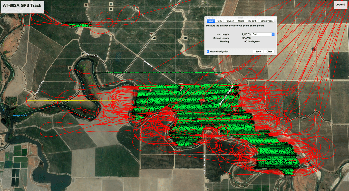
Note: This is a reproduction of an article which appeared in the NAAA eNewsletter on June 2, 2022.
A Minnesota aerial applicator did such a thorough job explaining the adverse effects a proposed wind energy project would have on aerial applicators and the farmers they serve in the affected area that his comments to a state official conducting an environmental review serve as an outstanding model for any aerial applicators grappling with infrastructure projects that could affect their ability to serve area farmers.
Ryan Lubben owns West Central Ag-Air Inc. in Fergus Falls, Minnesota, but has frequently spent time applying fungicides and insecticides on farms a few hours south of Fergus Falls in Dodge County, Minnesota. His comments to an environmental review manager at the Minnesota Department of Commerce systematically explain why the NextEra Energy Resources Dodge County Wind Project, as currently planned, would be incompatible with aerial applicators’ ability to safely provide services to farmers located within the wind project’s widespread footprint.
As an opening salvo, Lubben provided facts about the aerial application industry and his company’s operations, but then he went several steps further to highlight the importance of aerial application to farmers and clearly illustrate the unacceptable safety risks the densely clustered wind turbine project would present to aerial applicators. The comments came together rather quickly once he gathered a few Surety maps and overlayed his GPS logs onto them.
Before getting into the hazards of the proposed wind farm, Lubben gave examples of three reasons why growers need to retain the ability to use ag aircraft. The three reasons he cited were efficiency, economics and environmental benefits. For his economics example, Lubben wrote:
Growers in the area typically get an average of a 17 bushel increase in corn yield by applying a fungicide during the tassel stage of development. (Per conversation with a local grower) Using today’s cash corn price of $7.63/bushel, this equates to an increase of $129 per acre. My company would charge roughly $21/acre for this application including chemical. That translates to $108 per acre of profit for the farmer, or a 500% return on investment!
Lubben then moved into the “show” portion of his show-and-tell comments, using his own Surety maps and GPS logs to illustrate to the environmental review manager how the proposed wind turbine construction would jeopardize his and other aerial applicators’ ability to safely enter, exit and return to farmers’ fields in the areas surrounded by the wind turbine clusters and the associated transmission line.
Lubben included the map below of the Dodge County Wind Project area and explained that the GPS flight tracks from his operation for one season were overlaid onto it. (See Figure 1) Next, Lubben illustrated safe turnaround distances necessary to make aerial applications safely. (See Figure 2)
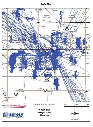
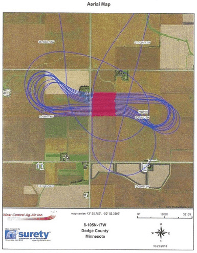
[Figure 2] shows the GPS flight tracks from a typical field being sprayed. The blue lines are the flight path and the red lines are the actual spray swaths.
As you can see, the aircraft needs quite a large area to have room in order to turn around on the end of the field. In fact, most of the flying takes place outside of the field being treated. The distance needed for this particular aircraft is approximately ¾ of a mile. As a rule of thumb, and [the] aircraft needs a full mile of distance on the end of the field to make a safe turn around. Obstacle free turn around areas is critical for these aircraft as the turnaround maneuver is when the aircraft is quite slow and vulnerable to an aerodynamic stall. The applicator must remain focused at this point and cannot be distracted by obstacles, and must have ample room to make the maneuver.
Finally, Lubben included a map showing the proposed locations of the Dodge Center wind turbines in the western portion of the project area. (See Figure 3)
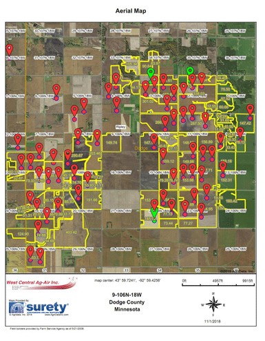
Each red dot indicates a turbine location. I have highlighted the fields in yellow which would not meet the criteria of having a one mile turn around obstacle free zone on the end of the field. I estimate this map to be a conservative representation of what fields cannot be serviced by ag aircraft. … this is just a portion of the wind farm area. There will be many more fields affected.
Clearly this proposed wind farm will have far reaching impacts on growers in the area in regard to aerial application. Quite frankly the density and random turbine layout will make it impossible for aerial applicators to work safely.Furthermore, it may be impossible for growers in the area to even entice an applicator to come in and do any work in the larger area.
Lubben isn’t opposed to all wind turbine projects and has even had success working around another wind energy site not far from the proposed NextEra Energy Resources wind project. He closed his comments by pointing out the distinctions between the two wind projects:
The incredibly large scope and density of the Dodge County wind turbine layout is what is the issue here. Changes can be made for the area to keep aerial application while still producing wind power. A perfect example of this is the McNeilus wind farm located just two miles south of the Dodge Center airport. This wind farm has the towers lined up and contained in a small area. I have actually been quite comfortable spraying fields in this area because I know I can exit the turbine area in a straight line and make my turn arounds outside of the wind farm. This could easily be done in the proposed wind farm by orientating the wind towers in groups or in straight lines and leaving a mile buffer between groups or lines to allow room for aircraft turn arounds.
NAAA commends Ryan for his sophisticated yet simplified explanation of the ramifications that ill-planned wind energy projects can inflict on aerial applicators and their farming customers.
METs are structures erected to verify the wind conditions at prospective and operational wind farm sites. They are typically between 50-199 feet tall and 12 inches or less in diameter. Many are erected only temporarily to test sites for wind farm suitability. As of 2018, and in-part due to NAAA and state agricultural aviation association advocacy, METs and their supporting guy wires are required to be both marked and logged with the FAA. They pose a unique risk to aerial applicators, as they can be erected in what was a familiar field in a very short period of time. In addition, METs placed within operational wind farms can be difficult to spot as an aerial applicator is focused on avoiding the wind turbines themselves.
Overhead utility wires pose a significant safety hazard to low-altitude aviation. Of the fatal ag aviation accidents over the past decade, nearly a quarter were caused by striking a wire. NAAA and NAAREF have expended great effort on education and outreach for wire strike avoidance, and they continue to reach a broader audience each year. Far less progress has been made on physically marking difficult wires to increase their conspicuity. The reason for this lies mainly in the disparate and disjointed US utility network, wherein there are thousands of individual utility companies. While wire strike accidents are significant at a national level (not only from low-altitude aviation, but more commonly from construction/farm equipment), the individual hyper-local utility company may not clearly see the investment potential in wire marking.
In an effort to educate local utility companies and/or municipalities on the advantages of wire marking, NAAA provides a short powerpoint with video, which can be customized and used by Operators, affecting change at the local level. This presentation highlights use of the ROTAMARKA™ rotating wire marker, which is distributed in the US through Sicame USA.
NAAA Newsletters on this Issue
The National Transportation Safety Board (NTSB) released a Special Investigative Report (SIR), SIR14/01, in 2014 addressing agricultural aircraft accidents which occurred during the period from January through early October 2013. The NTSB released the report along with safety recommendations to both the FAA and the ag aviation industry.
The NTSB report concluded with four action items that could be implemented jointly by the FAA and NAAA through NAAREF and its educational programs. These issues and areas are:
- Guidance for fatigue management is lacking for agricultural aircraft operations, and such guidance could help operators and pilots develop effective strategies to reduce the likelihood of fatigue, dehydration, hunger, and other physiological factors that can negatively affect a pilot’s concentration, decision-making, and performance.
- Risk management guidelines and best practices specific to agricultural aircraft operations are necessary tools to help operators and pilots mitigate the unique risks associated with their operation. Risk management is a decision-making process by which pilots can systematically identify hazards, assess the degree of risk, and determine the best course of action.
- A resource that contains detailed information related specifically to agricultural aircraft inspection, maintenance best practices, and quality assurance can reduce the likelihood that unsafe practices may be introduced and perpetuated.
- Standards and procedures are essential for safe operations, and, without a resource that contains detailed information related specifically to the agricultural aircraft operations knowledge test topics and skills test items in existing FAA guidance materials, unsafe, nonstandard practices can be introduced and perpetuated.
In addition to the special investigation report, a video titled “Improve the Safety of Agricultural Aircraft Operations” was also produced to accompany the report. Investigators also developed a new NTSB Safety Alert number SA-035 titled “Preventing Obstacle Collision Accidents in Agricultural Aviation,” to help pilots and operators better avoid obstacles such as Meteorological Evaluation Towers (METs). The NTSB mentioned in the SIR the need for more action by the FAA and the American Wind Energy Association (AWEA) and other entities to better mark these obstacles. The NTSB issued a safety recommendation that FAA require all METs be registered, marked and—where feasible—lighted; and that a publicly accessible national database for all METs be developed.
- Fatigue issue: The 2015-2016 Human Factors Module of the PAASS program addressed the topic of pilot fatigue. NAAREF produced a brochure about recognizing and dealing with fatigue in ag aviation. Additionally, the May-June 2015 issue of Agricultural Aviation magazine and other publications focused on fatigue. NTSB was updated on these activities in August of 2015.
- Risk management issue: the Human Factors Module of the 2016-2017 PAASS Program was titled “Risk Management in Agricultural Aviation”. It addressed the NTSB’s list of goals for NAAREF educational programming on this issue.
- Aircraft maintenance issue: The 2017-2018 PAASS Program Human Factors Module titled “Maintenance Related Aircraft Accidents” educated attendees of the need to properly maintain and inspect their aircraft to make sure they are airworthy and in top operating condition.
- In June 2018, NAAA/NAAREF updated the NTSB on the above listed educational accomplishments addressing the SIR issues. NAAREF received a response letter from the NTSB in August 2018. NTSB considered the recommendations on guidance on fatigue management and aircraft inspection and maintenance to be “Closed with Acceptable Action.” The recommendation on ag aircraft risk management guidelines is acceptable pending an FAA Safety Alert for Operators (SAFO) before closing that recommendation. The final recommendation from the SIR to be addressed was developing and distributing guidance on part 137 knowledge and skills test areas.
- In March of 2020 the FAA released a Safety Alert for Operators (SAFO) for 14 CFR Part 137 Operations that provides information on the best practices for agricultural aircraft operations. This SAFO closed the recommendation on ag aircraft risk management guidelines.
- The only remaining open SIR recommendation is on the developing ag aviation knowledge and skills guidance.
- An NAAA Knowledge and Skills Subcommittee was formed to develop guidance on part 137 knowledge and skills issue.
- The subcommittee considered opening Part 137 to require what the subcommittee would develop or linking it to Letter of Authorization (LOA); FAA legal advised neither option was viable.
- The subcommittee began development of ACS (Airman Certification Standards) documents for all the areas of operation from 137.19e.
- The first draft of the ACS was completed in February of 2021 and reviewed by two attorneys. Richard Kimmel was concerned that the document could be used against agricultural aviators in individual court cases. Attorney John Wright felt the ACS would be neutral in litigation and could be used for or against an aerial applicator depending on the individual case their professionalism.
- An edited version of the ACS was renamed to AACG (Agricultural Airman Certification Guidelines) and discussed at the October 2023 NAARF Board of Directors meeting. NAAREF decided to have the document reviewed by a group of selected reviewers to be given instructions to provide a simple yes or no vote on the suitability of the AACG.
- In 2023 the NAAA Education Center was launched to house the registration and participation tracking for PAASS and Operation S.A.F.E. The educational center will also contain online educational modules in a Learning Management System (LMS) that will track and verify user participation in the training. The LMS structure will be based on the AACG.
- The NTSB has endorsed these activities but indicated they would need to see the final modules that impart the knowledge before they can sign off on completion of the knowledge and skills guidance development item.
- Wire strike avoidance and droplet size courses launched on the NAAA Education Center in early 2024.
- The Agricultural Airman Guidelines (AAG) were published in May of 2024
- In May 2024 NAAA sent letter to NTSB detailing the AAG and Education Center and describing how they address the ag aviation knowledge and skills guidance
- IIMC and Droplet Size Part 2 Course launched on NAAA Education Center in December 2024.
- In March 2025 the NTSB closed Special Investigative Report (SIR) SIR-14/01, indicating that the AAG and Education center “Exceeds Recommended Action”.
After a five-year effort, the Department of Transportation’s Federal Motor Carrier Safety Administration (FMCSA) granted NAAA’s request to propose a regulation allowing states to exempt commercial drivers from having to get a HazMat endorsement to transport 1,000 gallons or less of jet fuel (aviation-grade kerosene). The NPRM was released on December 4, 2024 and comments were accepted through February 3, 2025. NAAA submitted comments in support of the rule and advocated that membership and others do the same.
Presently, drivers with a commercial driver’s license (CDL) must obtain a HazMat endorsement to transport jet fuel. The FMCSA waived the HazMat endorsement for the transportation of 1,000 gallons or less of diesel fuel. NAAA, due to the need to augment the pool of available commercial drivers to aid aerial application businesses and due to the extremely similar chemical properties of diesel and jet fuel, petitioned for an amendment to 49 CFR 383.3(i) to have this exemption extended to jet fuel as well.
NAAA’s justification for the waiver from the hazardous materials endorsement stems from difficulties finding potential employees to transport commercial motor vehicles for agricultural aircraft operators due to the drivers leaving for year-round work once they receive their CDL and hazardous materials endorsement from a seasonal aerial application business. Another difficulty is finding Department of Motor Vehicle (DMV) locations and scheduling testing times to take the knowledge and skill tests required for a CDL in rural areas, where most aerial application businesses are. The closest DMV could be several hundred miles away. NAAA cited American Trucking Association statistics to the FMCSA that there was a shortage of 80,000 drivers and that the bipartisan infrastructure bill Congress passed in the fall of 2021 takes a step toward allowing 18-year-olds to apply for a CDL, down from the current national age limit of 21—another indication that trucking shortages have significantly affected the agriculture sector.
The path toward the FMCSA granting NAAA’s request to propose a regulation has had its challenges. It had been held up at the Transportation Security Administration. Then it was initially denied, but NAAA persevered and showed that the similarities between jet fuel (aviation-grade kerosene) and diesel, which has the HazMat exemption for transporting limited quantities, were nearly identical. NAAA also provided information to the FMCSA showing that its request for a waiver would not jeopardize safety since aerial application operators with CDLs are driving on rural roads and for shorter distances, mostly less than 20 miles, to go from one satellite strip to another. They also drive when the weather is favorable to make applications, not in foggy, rainy and cold and snowy weather due to aerial applications not typically being made during these times.
NAAA greatly appreciates the work of board member Matt Woolard of Woolard Flying Service Inc. in Arkansas and Katherine Holmstrom, executive director of the Arkansas Agricultural Aviation Association, in seeking this waiver. NAAA recently spoke to the FMCSA Office of Policy’s associate administrator and was told that a firm date to release the final rule is still uncertain due to staffing changes and getting the new political appointees up-to-speed, however, due to the uncontroversial nature of the rule it doesn’t seem that there are any problems with the proposal.
The use of WebOPSS to update and reissue a Part 137 operator’s LOA A003 has caused confusion with some ASIs, who have mistakenly concluded that Part 137 operators need to fulfill various OpSpecs requirements. As a consequence, NAAA has fielded numerous calls from operators who have had an ASI insisting an aircraft be inspected or ownership of it proven before it can be added to their LOA A003.
Recent FAA guidance has clarified, in summary:
- Notify your FSDO when you add an aircraft to your operation; they must add the aircraft to your LOA A003 and re-issue the updated form to you.
- You are not subject to the requirements of OpSpecs.
- You do not have to have an aircraft inspected before it is added to your LOA A003.
- You do not need to provide proof of ownership, lease or any other agreement of use for your Part 137 operation’s aircraft.
14 CFR Part 119 prescribes the regulatory framework for commercial operating certificates. However, §119.1 defines its applicability primarily to Part 121 (airlines) and 135 (air taxi) operations. Part 137 Operations are specifically excluded (see §119.1(d)).
Each certificate holder subject to Part 119 must have Operations Specifications (OpSpecs) in accordance with §119.7 which contain (1) The authorizations, limitations and certain procedures under which each kind of operation, if applicable, is to be conducted; and (2) Certain other procedures under which each class and size of aircraft is to be operated.
In the aftermath of the 9/11 terror attacks, Congress mandated the FAA to develop a system to track all Part 137 operators and aircraft in the interest of national security. The FAA already had a nationwide database in use to track operations subject to OpSpecs. FAA elected to extend the use of this database to other purposes, such as tracking Part 137 operators and letters of authorization for certain activities. This database, the Operations Safety System (OPSS) eventually evolved into WebOPSS which is still in use today.
The use of WebOPSS, once known internally as “the OpSpecs database,” for Part 137 letters of authorization (LOA) became the source of widespread confusion. Aviation safety inspectors (ASI) were accustomed to referring to any information in this database as “OpSpecs,” and since much of the user interface looked the same, they starting processing them as such.
This led to ASIs requesting Part 137 operators to sign OpSpecs documents, and erroneously requiring them to submit to aircraft inspections and demonstrate aircraft ownership prior to adding those aircraft to their LOA A003.
Contributing to the confusion were several iterations of poorly worded guidance in FSIMS, (formerly referred to as the Inspector’s Handbook) which left open to interpretation the applicability of OpSpecs for Part 137 operators.
Thankfully, today, the ASI guidance in FSIMS is much clearer on the fact that Part 137 operations are not subject to the requirements of OpSpecs.
The Flights Standards Informational Management System (FSIMS) is an electronic documentation system adopted by FAA to replace the legacy ”inspector’s handbook” and is comprised of approximately 8,000 pages of non-regulatory guidance and policy essential to the Aviation Safety Inspector (ASI).
The FSMIS Guidance for this topic can be found in FAA’s Dynamic Regulatory System (DRS) by navigating the drop-downs as indicated below:
- » Volume 3 – General Technical Administration
- »» Chapter 52 – Part 137 Agricultural Operations
- »»» Section 1 – Introduction to Part 137 Related Tasks
The direct link to Section 1 – Introduction to Part 137 Related Tasks is provided here, however, FAA has advised that DRS links are frequently subject to change. Thus, if the direct link doesn’t work, you can use the above provided navigation instructions. An excerpt from the relevant text from the guidance (CHG 825, dated 12/30/22) is below.
3-4227 WEB-BASED OPERATIONS SAFETY SYSTEM (WebOPSS). Aviation safety inspectors (ASI) should use WebOPSS to issue part 137 Letters of Authorization (LOA) to agricultural aircraft operators. These authorizations should be issued during initial certification and modified when an operator requests a change or a change is directed by the General Aviation and Commercial Division (AFS-800). There is no requirement for part 137 operators to hold digital signature capabilities. The principal inspector (PI) must digitally sign the WebOPSS authorizations and then request the operator’s signature. It is acceptable to send or receive these authorizations by fax or email for the operator’s signature.
NOTE: Part 137 WebOPSS authorizations are not subject to the requirements of 14 CFR part 119 for operations specifications (OpSpecs). ASIs should refer to these paragraphs as “part 137 authorizations,” not OpSpecs.
3-4228 ADDING OR REMOVING AN AIRCRAFT.
A. Operator Notification to the Federal Aviation Administration (FAA). Part 137 operators who have already been certificated should notify the responsible Flight Standards office whenever they add an aircraft to their operation. Before engaging in agricultural aircraft operations, operators should provide copies of the current registration and Airworthiness Certificates to the responsible Flight Standards office and request the aircraft be added to their LOA A003. UAS typically do not have an Airworthiness Certificate; therefore, operators of UAS are responsible to ensure that the aircraft is in a condition for safe operation in accordance with part 107 or their 49 U.S.C. § 44807 exemption.
B. Inspector Procedure. When informed by a part 137 operator of the addition (or removal) of an aircraft, inspectors will:
- Update and reissue LOA A003 in WebOPSS,
- Issue LOA A005 for exemption holders, and
- Update the operator’s enhanced Vital Information Database (eVID) Air Operator file.
C. Aircraft Inspection and Listing on LOA A003. The operator should request that the aircraft be added to LOA A003 before it is used in agricultural aircraft operations; however, there is no regulatory requirement for an aircraft to be inspected prior to it being listed on LOA A003. At a later agreed-upon time, an inspector from the responsible Flight Standards office may inspect the aircraft. A full conformity inspection is not required. Inspectors may always conduct an agricultural aircraft inspection in accordance with § 137.59. See Volume 6, Chapter 6.
D. Aircraft Ownership. There is no requirement for aircraft ownership interest under part 137. Section 137.19(d) is satisfied if a part 137 operator merely has use of at least one certificated and airworthy aircraft equipped for agricultural operation. The use of at least one aircraft includes ownership of the aircraft as well as any agreement for use of the aircraft, regardless of the period or the exclusive nature of the use.
Uncrewed Aircraft Systems (UAS)
UAS, also known as Unmanned Aerial Vehicles (UAVs), unmanned aircraft (UA) or drones may pose a potential a safety threat to low-altitude crewed or manned aviators, especially ag aviators, if operated carelessly. They also could complement an aerial application operation; purpose-built aerial application UAS may be employed to treat areas that might pose a safety risk to manned agricultural aircraft. NAAA believes FAA needs to take a measured, incremental approach to safely integrate UAS into the National Airspace (NAS). This means that the Agency needs to fully assess the risk of UAS to crewed aircraft as they incrementally open the airspace to UAS, preserve the rule of UAS always providing the right-of-way to manned aircraft and ensure their equipage of a tested, effective detect and avoid system be equipped on UAS.
Effective since 2016, 14 CFR Part 107 allows small (less than 55 lb.) UAS to be operated commercially with a Remote Pilot Airman Certificate and Small UAS Rating. There are currently over 420,000 Certified Remote Pilots. Operating limitations to Part 107 include a maximum groundspeed of 100 MPH and a maximum altitude of 400 feet AGL (lowered from 500 feet thanks, in part, to NAAA comments). Only visual line of sight operations of a single UAS are permitted and all UA must yield right of way to manned aircraft. Some of these rules can be waived by FAA if an applicant demonstrates that such a waiver will not endanger the NAS and persons on the ground. Part 107 was amended in 2021 to allow operations over people and at night.
To fly a UAS that exceeds the maximum weight in Part 107, or if the use requires relief from a non-waiverable rule, a petition for exemption may be filed under the authority of 49 U.S.C. §44807 – Special Authority for Certain Unmanned Aircraft Systems. This allows a risk-based case-by-case determination of whether certain UAS may operate safely in the NAS. These exemptions are a type of federal rulemaking, but most petitions are granted as a “summary grant” using a materially similar prior granted petition as justification. The FAA must publish a petition for public comment if granting the exemption would set a precedent. NAAA has commented on over 100 of these petitions, asking the FAA to require a series of safety measures (approved previously by the NAAA Government Relations Committee) as follows:
- Crewed aircraft should always have the right-of-way over UAS.
- Commercially utilized UAS should be certified by FAA as airworthy
- Before UAS operate in areas commonly trafficked by crewed aircraft, such as above farms, they should be equipped with ADS-B In to be able to detect crewed aircraft with ADS-B Out. Ultimately, NAAA believes that UAS should be mandatorily equipped with FAA-certified detect and avoid (DAA) technology that detects crewed aircraft (both cooperative and non-cooperative) and alerts UAS to their position so they can give way to them.
- The above DAA technology should be a prerequisite for Beyond Visual Line of Sight (BVLOS) operations.
- UAS should be equipped with visible strobe lighting, and ideally painted in readily distinguishable colors, such as aviation orange and white, to increase visibility.
- UAS pilots should be held to a standard similar to crewed aviation pilots. This includes requiring a pilot certificate to demonstrate proper knowledge of the NAS, as well as a third-class medical certificate to demonstrate physical capability to operate a UAS.
- Notices to air missions (NOTAMs) should be filed 48 – 72 hours prior to UAS flights.
Effective September 16, 2023, all UAS are required to broadcast timestamped identification, location, altitude and velocity information via Bluetooth/WiFi. Remote Identification (RID) is hailed as the next incremental step toward further integration of UAS in the NAS. It has been further described as a digital license plate and will be helpful to law enforcement and regulators to ensure responsible and safe UAS use. There have been situations where UAS were not operated legally; however, no enforcement action was taken because it could not be determined with certainty who was operating the UAS or where it was operating. NAAA has pushed the FAA to require identification for UAS since before they were first approved for commercial use in 2014.
NAAA advocates for the safety of crewed aerial application by asserting the unique challenges associated with avoiding encounters with UAS in the low-altitude airspace. Aside from outreach to FAA, as required, this primarily consists of providing comments to precedent-setting §44807 exemptions for UAS operators and manufacturers which are perceived to reduce safety.
Since 2016, NAAA has partnered with Mississippi State University’s (MSU) Raspet Flight Research Laboratory, a core member of the FAA’s Alliance for System Safety of UAS through Research Excellence (ASSURE) program, to build a nationally representative dataset of crewed aerial application operations GPS flight logs. The primary intent of this collaboration is to promote safety of crewed aerial application operations as UAS are integrated into the National Airspace. Put simply, this data proves and defines airspace occupation by aerial applicators. As of 2024, over 30,000 individual flight logs have been (and continue to be) donated by NAAA members to fuel this effort.
In 2023, this dataset began to be incorporated into a larger effort by the University of North Dakota (UND) to quantify airspace occupation of shielded areas as proposed in FAA’s UAS BVLOS ARC report. By combining these flight logs with the results of a survey of aerial applicators on the same topic also conducted by UND in 2023, clear evidence was found and documented that crewed aerial application operations routinely operate within these proposed shielded areas, proof which NAAA used to support its opposition to codification of any shielded areas language in BVLOS rulemaking.
- In 2020, the American National Standards Institute (ANSI) published the second version of the UAS Standardization Collaborative (UASSC) Roadmap to facilitate the safe integration of UAS into the national airspace. The UASSC was not tasked with developing standards itself, but rather help identify standards that need to be developed by standard developing organizations such as the American Society of Agricultural and Biological Engineers, who also develops standards related to aerial applications. As part of UASSC, NAAA ensured that standards and research related to the safety risks UAS present to agricultural aircraft and other low-altitude aircraft were identified and included in the roadmap.
- In 2022, the FAA UAS BVLOS Aviation Rulemaking Committee (ARC) submitted its report with recommendations to the agency. NAAA digested the report and sent a letter to both Department of Transportation Secretary and to FAA Administrator explaining the hazard that UAS flying BVLOS pose to crewed aircraft when sharing the 10- to 500-foot AGL airspace. An ARC makes recommendations, not policy. The FAA considers ARC reports and recommendations before proceeding with draft policy. The recommendations from this UAS BVLOS ARC were not unanimously supported. Helicopter Association International, the General Aviation Manufacturers Association, Aircraft Owners & Pilots Association and Air Line Pilots Association voted against the ARC’s recommendations and were just a few of the crewed aircraft organizations asked to serve on the FAA UAS BVLOS ARC. Of particular concern to NAAA among the ARC’s recommendations:
- BVLOS UAS would have §91.113 right-of-way over any non-ADS-B-Out-equipped aircraft under 500 feet AGL.
- BVLOS UAS would have §91.113 right-of-way over all other aircraft within shielded areas (the volume of airspace within 100 feet vertically and horizontally of any obstacle or critical infrastructure) and not have to equip with DAA.
- In 2022, NAAA sent a letter to the FAA administrator expressing concern over the increase in number of Part 107 waivers granted allowing drones to operate BVLOS by allowing the remote pilot in command or a visual observer to view the airspace involved, but not the drone itself. This method of operation has not been tested with low altitude aircraft such as aerial applicators and it is uncertain if it is a safe reliable method of traffic management. NAAA urged the FAA to suspend the issuing of these waivers.
- In January 2023, the FAA acknowledged receipt of the letter and responded that the waivers issued are following guidance in FAA Order 8040.6 Safety Risk Management Policy for UAS. While this policy might be effective for some areas of aviation, NAAA maintains that this method is not proven with crewed agricultural aircraft. The agency fell short of NAAA recommendations to cancel further 107.31 waivers until these methods of traffic deconfliction are tested. NAAA will continue to insist that uncrewed traffic management be tested with the unique operating parameters involved with crewed agricultural aircraft.
- In May 2023, the FAA published four precedent-setting UAS BVLOS Exemption Petitions alongside a broader proposed rule for public comment. If adopted, some of the most troubling recommendations from the UAS BVLOS ARC report may become a reality. Of specific concern to ag aviators, the rule would give UAS the right of way over crewed aircraft in shielded areas. NAAA commented in opposition to all four exemption petitions as well as the proposed rule on BVLOS expansion and shielded operations. Therein, NAAA stressed the necessity to (1) have UAS certified as airworthy, (2) require UAS to always give the right of way to crewed aircraft and (3) assert that DAA systems must be certified by the FAA and be shown performant against aerial application operations.
- In July 2023 the House of Representatives passed an FAA reauthorization bill that included language that would amend section 49 U.S.C. § 44807, which is the section that provides the FAA to all certain exemptions to allow drones over 55 pounds to operate in low-altitude airspace. The amending language states that “Nothing in this subsection shall be construed to give an unmanned aircraft operating pursuant to this section the right of way over a manned aircraft.” The introduced bill was still void of low-altitude manned aircraft safety provisions from drones operating BVLOS. As a result, NAAA enlisted the support of Congressman Bruce Westerman (R-AR) and Rick Crawford (R-AR) to introduce an amendment to that section directing the FAA to “ensure the safety of manned aircraft operating in the national airspace system.” Thanks to Congressman Sam Graves (R-MO), chairman of the House Transportation and Infrastructure Committee that has jurisdiction over the bill, the amendment was unanimously accepted resulting in its inclusion in the bill.
- In October 2023, the FAA hosted aviation stakeholders in a listening session to present the concepts under consideration by the agency for an upcoming BVLOS rulemaking. Some of the concepts presented were disconcerting, and as such, NAAA, working with seven other national general aviation industry groups responded to the FAA’s listening session concepts in a letter dated December 22, 2023. The letter emphasizes a commitment first and foremost to aviation safety; underscores that the foundational responsibility of complying with the 14 CFR 91.113 right-of-way regulation does not change because the aircraft is being operated remotely instead of by a pilot occupying a cockpit; opposition to imposing or expanding any existing aircraft equipage mandate in order to enable BVLOS UAS operations as part of the rulemaking; that BVLOS UAS should be equipped with sufficient DAA technology; and that shielded areas should not be based on the ARC’s definition, rather it should be grounded in the tangible, physical shielding of a UAS operating within these zones, rather than a mere proximity to obstacles.
- In May 2024, the FAA Reauthorization Act, specifically 49 U.S. Code §44811, mandated that FAA establish a regulatory pathway for UAS to operate BVLOS, which requires, in-part, that the NPRM establish “the safety of manned aircraft operating in the national airspace system and consider the maneuverability and technology limitations of certain aircraft.”
- In August 2025, the FAA issued the long-awaited NPRM for enabling routine BVLOS operations. This rulemaking seeks to create 14 CFR Part 108, under which UAS operations for missions such as package delivery, surveying and aerial applications would take place under either a permit or certificate. This NPRM would also amend Part 91 to grant right-of-way to Part 108 UAS over all other aircraft, unless that other aircraft is broadcasting ADS-B or electronic conspicuity (EC). Further, it would define shielded areas as the airspace within 50 feet of powerlines, railroad tracks and pipelines, and in those areas absolve Part 108 UAS from yielding right-of-way to any other aircraft.
- In September 2025, NAAA released a draft of its comments on the BVLOS NPRM to the ag aviation community in a grassroots effort to solicit comments from aerial applicators to FAA on the safety impacts the provisions of the NPRM would have on their operations. In concert, NAAA worked to educate and leverage influential voices on this topic ranging from agricultural commodity groups and federal agencies to general aviation organizations and transportation safety agencies.
- In October 2025, NAAA submitted its comments on the BVLOS NPRM. These comments highlighted NAAA’s long and consistent track record of safety advocacy, cited all relevant sources to demonstrate the extent of aerial applications utilization of airspace, and made pointed, fact-based arguments against all proposed regulations which were deemed a safety threat to manned aerial application operations. The final rule is officially expected in early 2025 but based on the years of delay seen for the BVLOS NPRM, when to truly expect a final rule is anyone’s guess.
In December 2025, NAAA submitted comments in opposition to a petition for exemption from a Part 135 UAS package delivery operator which sought relief from regulatorily required submission of Service Difficulty Reports and Mechanical Interruption reports. NAAA’s main point of contention was that removal of these reporting mechanisms would lead to degraded FAA oversight of operational deviations and interruptions which include those made to avoid conflicts with crewed aircraft.
In January 2026, NAAA’s CEO attended a session hosted by FAA leadership regarding the BVLOS NPRM. In representing the interests of crewed aerial application pilots, firm, data-backed reasoning was put forth to highlight the concerns with right-of-way changes and shielded areas previously detailed in NAAA’s formally submitted comments.
If you or a pilot of yours has a near-miss encounter with a UAV or, worse, is hit by one, undoubtedly one of the main things going through your mind after the initial shock subsides is what to do and who to call to report the encounter. NAAA has prepared a handy checklist of steps to take after a UAV encounter. Follow these steps.
1. Inform Local Law Enforcement
When informing local authorities about the unsafe operation of a UAS, it is important to contact the enforcement body with jurisdiction over the area where the offense occurred. Call them immediately after the incident. Remember, local law enforcement agencies are not aviation experts, so be sure to provide them with ample and accurate information on why the operation was unsafe or illegal.
2. Report It To The FAA National Safety Hotline
After safely landing, you should report the incident by calling the FAA Safety Hotline at 1-800-255-1111 or online at hotline.faa.gov. This contact is a single avenue for anyone from FAA employees to concerned citizens to file a report regarding violations of federal aviation regulations or the safety of the national airspace.
3. Call Your Local Flight Standards Office (FSO)
Your local Flight Standards Office (FSO, formerly called FSDO) consists of aviation officials who should be more intimately familiar with your airspace. Make sure the person taking the report understands you believe a violation of the FARs has occurred. However, due to personnel shortages it might take some time for an investigation to be completed.
4. File A NASA Aviation Safety Report
The primary purpose of a NASA aviation safety report is to collect data related to the national airspace to reduce aviation accidents and incidents. Your confidential and non-punitive report will go directly into the Aviation Safety Reporting System (ASRS), ensuring your experience will be used as data to contribute to aviation safety. The incident information can be recorded on the General Report Form for electronic submission, or the form can be printed for completion and mailing by U.S. mail.
5. Tell Other Pilots
Whether it’s through social media, message boards, email or word of mouth, let other pilots in your area know when and where the UAS was flying. While pilots should always maintain alertness when it comes to avoiding other aircraft and obstacles, highlighting your UAS encounter can help other pilots maintain some extra situational awareness when flying in the area the incident occurred should the UAS operator return to fly in that same area again.
6. Notify Local News Media And Ag Trade Press
Share your encounter and safety concerns with the local media to inform the non-piloting public of these same concerns. Perhaps this will remind some UAS operators of the need for caution around manned aircraft operating at lower altitudes. Notifying ag media about your UAS encounter will help get the story out to the ag community.
7. Inform Your Customers, Ag Retailers And Crop Consultants
A UAV encounter is a teachable moment. Let farmers, ag retailers and crop consultants in the area know about the incident, including when and where it occurred and what the UAS operator should have done as the ag pilot approached the same airspace. If you intend to notify them in writing, include NAAA’s UAS Safety Stuffer with the notice.
8. Contact Your Insurance Agent If …
In the event physical damage is done to your aircraft, contact your insurance agent. The company will ensure repairs are made to the aircraft in accordance with your policy. There is a possibility the insurance company could pursue action against the parties that may be liable for the loss.
In addition to the UAV encounter checklist, NAAA is always available for additional assistance in the event of a UAV encounter with an ag aircraft. Contact NAAA at (202) 546-5722.
NAAA believes FAA’s integration of UAAS into Part 137 Aerial Application Operations must prioritize the safety of crewed aviation above all else. UAAS conduct work in the same low-altitude, rural airspace as crewed aircraft, and thus NAAA is vested in ensuring UAAS operators are held to a high safety standard. Since their initial introduction into the US market in 2014, heavy interest has driven regulatory change, simplifying the process to obtain a Part 137 certificate for UAS operations. As of early summer 2025, FAA listed over 1,700 UAAS operations.
As most UAAS are 55 lbs. or greater, they require an exemption under authority of 49 U.S.C. §44807. Nearly all petitions are processed without opportunity for public comment, citing a few previous “precedent-setting” exemptions. In other words, once a certain relief is granted to one operator, it is provided to all future applicants whether they request it or not. Below is a subset of the current boilerplate Part 137 exemption decision’s relief:
- Aircraft airworthiness certificate not required (Exemption 18009)
- Only a Remote Pilot in Command certificate is required for commercial part 137 operations, rather than a commercial pilot or ATP certificate. (Exemption 18009)
- Maintenance documentation, inspections and personnel certifications not required (Exemption 18009)
- No required FAA-administered Knowledge and Skills test (Exemption 19037B)
- No regular surveillance required by FAA as it is for crewed Part 137 operations (Exemption 19037B)
- Operation of up to 3 UAS simultaneously by a single Pilot in Command, without any visual observers, during night (Exemption 22003)
- No medical certificate is required, except for night operations which requires a third-class medical certificate.(Exemption 20257A)
NAAA also believes that EPA should ensure UAAS are held to the same or comparable application standards for efficacy and drift as crewed aerial applicators. There is currently a distinct lack of publicly accessible data on the application characteristics for commercially available UAAS. This data is critical, not only in demonstrating application performance/efficacy, but in developing UAS-specific models to assess the risk of drift. Pesticide products must have risk assessments performed in order to be registered, and the drift risk profile of aerial applications is used to determine whether that product may be applied aerially. The Spray Drift Task Force conducted scores of field trials with fixed wing and single rotor aircraft 30 years ago to build this risk profile. UAS travel at lower speeds and may have multi-rotor configurations, so their risk profile may be very different and may merit separate labeling considerations.
- In 2020, NAAA wrote a letter to the EPA urging them to begin testing UAAS to evaluate application accuracy and drift potential, stressing the need to incorporate them into the AgDRIFT model and into the risk assessment process for pesticide registration and re-registration to ensure aerial applications by UAAS realize the same environmental safety standards as crewed agricultural aircraft.
- In 2020, the American National Standards Institute (ANSI) published the second version of the UAS Standardization Collaborative (UASSC) Roadmap to facilitate the safe integration of UAS into the national airspace. The UASSC was not tasked with developing standards itself, but rather help identify standards that need to be developed by standard developing organizations such as the American Society of Agricultural and Biological Engineers, who also develops standards related to aerial applications. As part of UASSC, NAAA played a major role in the section of the roadmap dealing with using UAS to perform aerial applications.
- In June 2023, the FAA issued Notice 8900.659, directing its staff with updated guidance on the Part 137 certification process for UAS. In July, NAAA sent a letter to the FAA expressing concerns with some of these changes. In August, FAA’s response to these concerns cited the backlog of UAS Part 137 applications as the primary driver for the changes, and contended that these operations inherently present lower risk. They did not, however, specifically address who was considered in these risk analyses, nor acknowledge Part 137 crewed operators as primary risk bearers of Part 137 UAS operations.
- In February 2024, the NAAA Board overwhelmingly approved the formation of a UAAS Committee, consisting of an equal number of NAAA crewed and uncrewed aircraft operation members. The committee will develop educational programs and public policy initiatives of mutual interest to both forms of aerial application.
- In March 2024, the FAA granted a precedent-setting Exemption which granted relief to operate up to three UAAS simultaneously under one PIC, during night, and without VOs within VLOS of the PIC. FAA confirmed to NAAA that all subsequent Exemption Petitions for Part 137 UAAS operators will automatically grant this so-called “advanced operations” relief. As of August 2024, over 200 such Exemptions had been granted.
- In June 2024, the FAA granted a precedent-setting Exemption which granted relief to conduct limited BVLOS UAAS operations with no VO when spraying fields that are surrounded by varying topology or boundaries of taller tress that obscure the view of the field.
- In September 2024, NAAA CEO Andrew Moore served as the featured speaker for the third FAASTeam Part 137 Drone Safety Webinar, promoting professionalism through NAAA membership and introducing NAAA’s new UAAS Committee, geared specifically for the session’s attendees to become involved in NAAA.
- In October of 2024 NAAA’s UAAS Committee met. The committee developed the following two motions that were approved by the NAAA Board:
- UAS must give the right-of-way to crewed aircraft in all cases; and crewed aircraft should circle the field before entering an application site.
- Any unlawful or unlicensed operations with any aircraft, crewed or uncrewed, should be reported to the proper authority.
- In December 2024, the FAA granted a precedent-setting Exemption which granted relief to conduct UAAS operations without a medical certificate (excluding night operations).
- In December 2024, the National Defense Authorization Act was signed, starting a one-year countdown in which Chinese UAS manufacturers, including DJI, must prove that its products are not a national security risk to the US or face being blocked from running on US networks.
- In January 2025, the Department of Commerce’s Bureau of Industry and Security issued an advanced NPRM with sights set on securing the information and communication technology and services (ITCS) supply chain for UAS. Specifically, they are determining what regulation should be required to address Chinese and Russian abilities to access and manipulate UAS, exposing US data.
- In February 2025, NAAA commented in opposition to an Exemption petition for a Part 137 UAS operator requesting to conduct operations without the requirement to file NOTAMs. As with any recent Part 137 UAS petition, any single decision will undoubtedly become “precedent-setting,” making this de-facto policy if the FAA decides to grant this relief.
- In June 2025, NAAA commented in partial opposition to an Exemption petition for a Part 137 UAS manufacturer requesting to conduct aerial application operations BVLOS of the PIC while employing dedicated VOs with a fixed-wing, 38-foot wingspan, 80 MPH working speed, 1,320-pound gross weight UAAS.
- The BVLOS NPRM would establish a new process in which UAAS operations would be permitted or certificated under the proposed Part 108, rather than Part 137. This would allow the vast majority of these operations to take place under codified regulations rather than operational exemptions.
- Work continues for NAAA UAAS Committee’s ad hoc group to construct documents for drone customers and drone operators underscoring regulatory, licensing and insurance requirements for both parties. The documents would be provided to trade press and extension services for drone customers and in application drone packaging for drone operators.
- In December 2025, the FCC (directed by the Executive Branch interagency body which includes appropriate national security agencies) added all foreign made UAS and UAS critical components to its Covered List, effectively prohibiting the import and sale of new UAS/UAAS. This does not affect UAAS and components previously authorized by FCC, and thereby operators of existing UAAS will still be able to obtain parts and previously approved UAAS models will remain available for sale/use.
- In December 2025, NAAA submitted comments on a petition for exemption to commercially operate uncrewed variants of the R22 and R44 for aerial application operations. While highlighting concerns for airworthiness, pilot certification and maintenance requirements, NAAA supported the petitioner’s request to operate with ADS-B Out, which would otherwise be prohibited since the aircraft is uncrewed.
- In January 2026, NAAA submitted comments in opposition of a petition for exemption to operate a UAAS from a moving vehicle for roadside and right-of-way pesticide applications. NAAA cited concerns with the operator’s ability to maintain VLOS in a dynamic environment as well as the enhanced collision risk with a large linear geographic area of operations abutting many fields in which crewed aircraft may be working.
The NAAA UAAS Committee created two flyers in 2026 aimed at educating both UAAS operators and their customers on what expectations should be set to ensure legal, safe and effective applications.
Both flyers have a QR code which directs them to an accompanying webpage with up-to-date links for all items. It is encouraged to share and disseminate these through any medium which will reach the intended audience.
For UAAS Operators
Ensuring Your Drone Applications are Made Legally and Safely
Lists basic requirements for operating legally as well as best practices for safe, effective and professional operations. This includes safely sharing the low-altitude airspace.
For Customers of UAAS Operators
Verify You are Hiring a Legal and Safe Drone Applicator
Lists basic requirements that should be verified to ensure the operator you hire is legal as well as further questions to ask such as evidence of spray pattern characterization.